
Flint Hills National Scenic Byway
Kansas
Flint Hills Scenic Byway, Kansas
Most drives take you past a landscape. The Flint Hills National Scenic Byway takes you into one. For about 48 miles, Kansas Highway 177 rolls south from the old Santa Fe Trail town of Council Grove down to the tiny hamlet of Cassoday, and the whole way it carries you across an ocean of grass. This is the largest unbroken swath of tallgrass prairie left anywhere in North America, a sea of big bluestem and wildflowers that once covered a huge chunk of the continent and now survives almost nowhere else. The road climbs and dips over rounded green hills, and the sky opens up so wide it can take a minute to get used to it.
The reason this prairie is still here is buried right under the wheels. The hills are laced with a hard, flinty rock, and that rocky ground was too tough to plow. Farmers who broke the prairie almost everywhere else simply could not break this. So the grass stayed, and cattle ranches took the place of cornfields, and the land kept its old shape. The federal government recognized what that meant. In 2005 it named this stretch of highway a National Scenic Byway, an honor reserved for roads with truly rare natural, cultural, and historic character. Driving it is the finest possible way to reach any Boutel in the Flint Hills.
Learn about Flint Hills National Scenic Byway
The Road
The byway follows Kansas Highway 177, usually written K-177, a paved two-lane state road. The signed scenic byway runs roughly 48 miles from Council Grove in the north down to Cassoday in the south, threading through Chase County and the heart of the Flint Hills. It is a gentle drive with no mountain passes and no white-knuckle switchbacks. The land here is flat to rolling, a series of long grassy swells that rise and fall like a slow tide, so any car handles it with ease.
What makes the drive special is the sheer openness. There are very few trees, very few fences you can see, and long stretches with no buildings at all. Cattle graze right up to the shoulder in places, and the road often crests a rise to reveal miles of green or gold prairie running to the horizon in every direction. Turnouts and low bridges over prairie creeks give you room to pull over, roll down the window, and listen. In spring and summer the grass ripples in the wind, and meadowlarks and other prairie birds sing from the fenceposts.
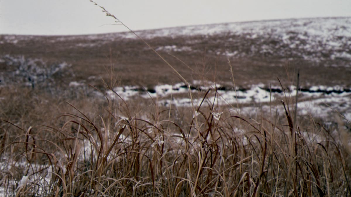
The prairie changes dramatically with the seasons, and that is part of the appeal. Spring brings tender green grass and wildflowers, and it is also burning season, when ranchers set controlled fires that renew the grassland and leave the hills briefly blackened before they green up again. Summer turns the bluestem tall and lush. Fall dries it to warm shades of copper and rust that glow at sunset. Even winter has its own stark beauty, the bare hills dusted with snow under an enormous sky. Whenever you go, the Flint Hills feel bigger and quieter than almost anywhere else in the country.
How to Get There
The byway sits in east-central Kansas, roughly between Wichita to the south and Topeka to the northeast, and it is easy to reach from Interstate 35, the main highway across the region. Coming from Wichita, drive northeast on I-35 to the Cassoday exit, then head north on K-177. From there the byway carries you up through the prairie all the way to Council Grove. Entering from the south this way is a fine choice, because the hills seem to grow taller and the prairie wider the farther north you go.
Coming from the Kansas City or Topeka side, take I-335 and then I-35 southwest toward Emporia, then pick up K-177 and head north to Council Grove, or join the byway near Strong City and Cottonwood Falls in the middle. Many travelers begin in Council Grove at the northern end and drive south, following the same direction the old Santa Fe Trail once ran. Either way works, and the drive is just as beautiful in both directions.
Wherever you start, top off your fuel tank first. Council Grove at the north end and the Cottonwood Falls and Strong City area in the middle have gas and food, but the long open stretches in between have almost no services at all. Filling up before you set out means you can slow down and enjoy the prairie without watching the gauge.
History
The story of this road begins with the rock beneath it. Hundreds of millions of years ago, shallow seas covered this part of Kansas and left behind layers of limestone. Some of those layers hold bands of a hard, glassy stone called chert, better known as flint. Over the ages the softer rock wore away faster than the flinty limestone, carving the land into the rounded, stair-stepped hills we see today and scattering the surface with flint. That is how the Flint Hills got their name, and that flinty, rocky, thin soil is the whole reason the prairie survived.
When settlers spread across the Great Plains in the 1800s, they plowed the tallgrass prairie almost everywhere, turning it into farm fields. In the Flint Hills they could not. The rock made plowing nearly impossible, so instead of crops the land grew cattle. Huge ranches took hold, and each year ranchers burned the grass, a practice they learned in part from the Native peoples who had used fire on these plains for centuries to keep the prairie healthy and to draw grazing animals. Because it was ranched instead of farmed, the Flint Hills kept more original tallgrass prairie than any other place in North America.
Council Grove, at the north end of the byway, adds a deep layer of American road history. In the 1800s it was a vital stop on the Santa Fe Trail, the great wagon route between Missouri and New Mexico. Traders gathered here to organize their caravans before heading into the open plains, and the town is still dotted with landmarks from those trail days. In that sense the byway follows a very old tradition, carrying travelers south across the prairie much as wagons once did.
The highway itself, K-177, served for decades as a plain rural road linking the small prairie towns. Its national moment came on September 22, 2005, when the Federal Highway Administration designated the roughly 48-mile stretch from Council Grove to Cassoday a National Scenic Byway. That honor is given only to roads whose scenery, nature, culture, and history are considered nationally significant. For the Flint Hills byway, all of those came together in one place: the last great tallgrass prairie, a landscape of working ranches, and a route woven into the story of the Santa Fe Trail.
Little-Known Facts
- The Flint Hills hold the largest remaining stretch of tallgrass prairie in North America. This grassland once covered a huge part of the continent, and today only a small fraction of it survives, most of it right here.
- The hills are named for flint, also called chert, a hard glassy stone locked inside their limestone. Native peoples across the plains prized this flint for making tools and arrowheads.
- The prairie survived for a simple reason: the rocky, flinty ground was too tough to plow. Farmers broke the tallgrass almost everywhere else, but here the land could only be ranched, so the grass stayed.
- The tallgrass here can grow astonishingly tall. In a good season, big bluestem grass can rise well over the height of a person, tall enough to hide a rider on horseback.
- Cassoday, at the southern end of the byway, calls itself the 'Prairie Chicken Capital of the World.' Each spring male prairie chickens gather on the grassland at dawn to dance and boom, inflating bright orange air sacs on their necks to attract mates.
- Ranchers deliberately burn the prairie in spring. The controlled fires clear away dead growth, hold back trees and brush, and spark fresh green grass that fattens the cattle, so a briefly blackened landscape is a sign of a healthy prairie.
- The stone courthouse in Cottonwood Falls dates to the 1870s and is the oldest courthouse in continuous use in all of Kansas, a rare survivor from the frontier era of the county.
- Council Grove, at the north end of the drive, was a key gathering point on the Santa Fe Trail, where 1800s wagon traders formed up their caravans before setting out across the plains.
Along the Route
Council Grove
Council Grove anchors the northern end of the byway and is a historic Santa Fe Trail town, one of the most important stops on that old wagon route between Missouri and New Mexico. Trail-era landmarks line its Main Street, and it is the last full-service town before the open prairie to the south, a good spot to fuel up, grab a bite, and get your bearings. Starting here lets you drive south the same direction the wagons once traveled.
Kaw Mission State Historic Site
On a rise at the north edge of Council Grove stands the Kaw Mission, an 1851 native-stone building raised as a boarding school for children of the Kanza, the people Kansas is named for. It tells an honest, uneasy story of a Santa Fe Trail town built on their homeland. It makes a thoughtful first stop before the drive, pairing history with the road ahead.
Tallgrass Prairie National Preserve
About halfway down the byway near Strong City, this preserve protects a large piece of the tallgrass prairie the whole drive celebrates. Miles of trails let you walk out into the grass, and a herd of bison roams part of the land, a living echo of the animals that once shaped this prairie. A restored stone barn serves as the visitor center. It is the single best place to step out of the car and truly stand inside the Flint Hills.
Strong City
Strong City is a small prairie town just north of Cottonwood Falls and right beside the entrance to the Tallgrass Prairie National Preserve. It grew up around the railroad and still has an old-Kansas feel. Along with neighboring Cottonwood Falls, it is one of the few places in the middle of the byway with fuel and food, a handy stop to refuel before the open stretches farther south.
Cottonwood Falls
Cottonwood Falls is the seat of Chase County and one of the most charming small towns on the drive, a place with no stoplights and a broad brick main street. At its head stands the stone Chase County Courthouse, built in the 1870s and the oldest courthouse still in use anywhere in Kansas, its French-inspired roof a surprising sight on the prairie. The town is an easy and rewarding side stop just off K-177.
Bazaar
Bazaar is barely a dot on the map, a tiny prairie community south of Cottonwood Falls, but the drive around it is some of the purest, most remote grassland on the whole byway. Here the hills roll away for miles with almost nothing built on them, just grass, sky, and grazing cattle. It is the kind of stretch where you slow down, roll the window down, and let the quiet of the open prairie sink in.
Cassoday
Cassoday marks the southern end of the byway and proudly calls itself the Prairie Chicken Capital of the World. Each spring at dawn, male prairie chickens gather on the surrounding grassland to dance and boom, puffing out bright orange air sacs to court the females. It is a tiny town with a big claim, and a fitting place to finish, or start, a drive through the last great tallgrass prairie.
Details
Council Grove and the Flint Hills
Frequently asked questions
When was the Flint Hills National Scenic Byway designated?
The Federal Highway Administration designated the Flint Hills National Scenic Byway on September 22, 2005. That national honor is given only to roads whose scenery, nature, culture, and history are considered nationally important. For this route, that meant the largest surviving tallgrass prairie in North America, a landscape of working ranches, and a deep tie to the old Santa Fe Trail.
How long is the Flint Hills National Scenic Byway, and how long does it take to drive?
The signed byway runs about 48 miles along Kansas Highway 177, from Council Grove in the north to Cassoday in the south. Driven straight through it takes roughly an hour, but most travelers give it much longer so they can stop at the Tallgrass Prairie National Preserve, wander the town of Cottonwood Falls, and pull over to take in the wide prairie views.
What are the must-see stops along the byway?
Heading south from Council Grove, the highlights include the historic Santa Fe Trail town of Council Grove itself, the Tallgrass Prairie National Preserve near Strong City, the charming county seat of Cottonwood Falls with its historic stone courthouse, the wide-open prairie around Bazaar, and finally Cassoday, the self-proclaimed Prairie Chicken Capital of the World. Numerous turnouts along the way make it easy to stop for photos.
Is the Flint Hills National Scenic Byway free to drive?
Yes. The byway is a public state highway, so driving it is completely free and no pass or permit is needed. The Tallgrass Prairie National Preserve along the route is also free to enter, though some ranger-led programs there may carry a small fee. You can enjoy the entire drive without paying anything.
What is the best time of day or year to drive the byway?
The hour after sunrise and the hour before sunset are magical, when low light turns the rolling grass golden. Late spring and early summer bring green hills and wildflowers, while fall turns the grass warm shades of copper. Spring dawns are also the season to catch prairie chickens dancing near Cassoday. Each season has its own beauty, so the choice comes down to what you most want to see.
Is the byway open year-round?
Yes. Kansas Highway 177 is a paved, maintained state highway with no mountain passes, so it stays open throughout the year. There is no seasonal gate or winter closure. Occasional snow, ice, or storms can make prairie driving slick, so it is always wise to check current road and weather conditions before setting out in the colder months.
Do you need four-wheel drive or high clearance to drive it?
No. The byway is a paved, two-lane state highway across flat-to-rolling prairie, and any ordinary passenger car handles it easily. There are no rough gravel sections or steep grades on the main route. Four-wheel drive and high clearance are not needed at all for the drive itself.
What are the winter driving conditions like?
In winter the road is generally easy, since it is paved and gently rolling with no high passes. The main thing to watch is weather. The Flint Hills are very open, so snow can blow and drift across the road, and ice can form on the bridges over prairie creeks. Give the road time to be cleared after a storm, keep your speed down, and check conditions before you go.
Are there gas stations and services along the byway?
Services are limited, so plan ahead. Council Grove at the north end and the Cottonwood Falls and Strong City area in the middle have fuel and food, but the long stretches in between have almost none. Fill your tank and pack water and snacks before you set out, and you can relax and enjoy the open prairie without worrying about running low.
Why is the Flint Hills prairie still here when almost all other tallgrass prairie is gone?
The answer is the flinty rock the hills are named for. Hard, chert-filled limestone lies just beneath the surface, making the soil too rocky and thin to plow. Settlers broke the tallgrass prairie into farm fields almost everywhere else, but here they could not, so the land was ranched instead. That is why the Flint Hills hold the largest remaining stretch of tallgrass prairie in North America.
Nearby

Flint Hills National Scenic Byway
0.0 miles away
Flint Hills Scenic Byway: K-177 from Milford to Cassoday, 177 miles. Free drive, no admission.

Kaw Mission State Historic Site
4.2 miles away
An 1851 native-stone building at the north edge of Council Grove, built by the Methodist church as a boarding school for children of the Kanza, the people Kansas is named for.

Tallgrass Prairie National Preserve
21 miles away
Tallgrass Prairie National Preserve: 2480B KS-177, Strong City. Free admission; open daily. Visitor center in the restored Stone Barn. Hiking: 40 miles of trails ranging from 1.5 to 19 miles.

OZ Museum
34 miles away
OZ Museum: 511 Lincoln Ave, Wamego, in the Flint Hills between Manhattan and Topeka. More than 2,000 Wizard of Oz artifacts trace the story from Baum's 1900 book through the 1939 film to today.