

Dubois Badlands
Kingfisher Rd
Dubois, WY
Bands of red and tan clay eroded into ridges and benches, on public land you can walk right into from the edge of Dubois.
Most people know Dubois for its mountains and its rivers, so the Dubois Badlands come as a surprise. Right at the eastern edge of town, the land drops into a maze of red and tan hills, ridges, and benches, carved by wind and water out of soft, colorful rock. It is a small pocket of the kind of eroded, painted-desert scenery you might expect much farther south, tucked into a valley otherwise framed by pine and snow-capped peaks.
The whole tract is public land, managed by the Bureau of Land Management as a wilderness study area, which means it has been kept undeveloped and open for people to explore on foot. There are no fees and no crowds. A short walk from the edge of town leads you into a quiet landscape of banded rock and big views, an easy adventure that most travelers drive right past without knowing it is there.
What Travelers Love
- Bright bands of red and tan rock eroded into an unexpected badlands landscape
- Short, easy-to-reach trails that leave from the edge of town
- Wide-open views across the Wind River valley to the surrounding mountains
- The quiet and the light, which turn warm and glowing in the early morning and evening
Worth Knowing
- The main way in is a trail from the intersection of Kingfisher Road and Mason Drive, just east of Dubois, where you park and walk in through a gate
- There is almost no shade once the sun is up, so bring water and sun protection and go early on hot days
- The soils and plants here are fragile, so stay on the main trails and avoid trampling the crusty ground between them
- There is no water and there are no services on the land, so carry everything you need and download a map, since side paths can be confusing
Learn about Dubois Badlands
A pocket of painted badlands
The Dubois Badlands cover a few thousand acres of eroded hills and flat-topped benches on the north side of the Wind River. Over long stretches of time, water and wind have cut into layers of soft sedimentary rock and clay, exposing bands of red, rust, and tan that stripe the hillsides. The result is a landscape of narrow ridges, small canyons, and intricate drainages, all packed into a surprisingly compact area.
Because the rock is soft and colorful, the badlands change with the light. In the low sun of early morning or late afternoon the reds deepen and the whole hillside seems to glow, which is why photographers love this spot. It is a striking contrast to the green valley and the high, often snowy mountains that rise all around, and it makes the badlands feel like a hidden little world of their own.
Walking the badlands
The easiest way in is a trail that begins near the corner of Kingfisher Road and Mason Drive, just east of Dubois. You park, pass through a gate, and follow the path as it climbs among the ridges and benches, opening up wide views across the Wind River valley toward the mountains. A common loop runs a few miles with only modest climbing, so it fits into a half day and suits most walkers who are comfortable on uneven ground.
One thing to know before you go: the ground here is delicate. The soils form a fragile crust, and rare plants grow between the trails, so it matters to stay on the main path rather than cutting across open ground. Several unofficial side trails branch off and can be confusing, so it helps to download a map ahead of time. There is no shade and no water, so carry plenty and time your walk for the cooler, prettier ends of the day.
Visiting the Dubois Badlands
The badlands are one of the easiest gems to reach anywhere in Wind River Country, since they sit right at the edge of Dubois. From town, it is a short drive to the main entrance on Kingfisher Road, where a gate and parking mark the start of the trail. That closeness makes this a perfect stop to stretch your legs on a travel day, or to catch sunrise or sunset without a long drive.
Plan for a warm-season visit, since the trails are exposed and can be muddy or snowy in the colder months. Bring water, sun protection, and sturdy shoes, and treat the fragile ground gently as you go. Give yourself an hour or two to wander the ridges, take in the banded rock and the valley views, and enjoy the quiet of a landscape most travelers never realize is hiding at the edge of town.
Closest Boutels
The closest Boutel™ stays, so you can turn this stop into an overnight. Each is a place we chose through independent editorial review, never a paid placement.
Details
Dubois, WY
Frequently asked questions
What are the Dubois Badlands?
The Dubois Badlands, near the town of Dubois in west-central Wyoming, are a colorful and scenic expanse of eroded badlands, with striking red, orange, and banded rock formations, hills, and gullies rising in the high desert near the Wind River. Protected in part as a wilderness study area, the badlands offer beautiful, rugged scenery and opportunities for hiking, wildlife viewing, and photography amid the dramatic, sculpted landscape. Set against the backdrop of the surrounding mountains, the colorful Dubois Badlands provide a striking contrast to the nearby forested peaks and river valley. With their vivid colors, eroded formations, and trails, the Dubois Badlands offer a scenic and uncrowded natural destination in west-central Wyoming.
What can you do at the Dubois Badlands?
You can hike the trails and routes through the colorful eroded badlands, taking in the striking red and banded rock formations and hills, photograph the vivid, sculpted scenery, especially beautiful in the golden light of morning and evening, watch for wildlife including bighorn sheep and other animals in the area, and enjoy the rugged, uncrowded landscape. The badlands offer scenic hiking and exploration. Their colorful formations make them a favorite for photographers. With their vivid badlands scenery, trails, wildlife, and photogenic beauty, the Dubois Badlands offer a scenic and peaceful outdoor experience near Dubois in west-central Wyoming.
What safety tips apply at the Dubois Badlands?
The badlands are in an exposed, high-desert setting that can be hot and sunny with little shade, so carry plenty of water, wear sun protection, and hike in cooler hours during warm months. The terrain can be rugged and the clay slippery and impassable when wet, so avoid the area after rain. Watch your footing on eroded slopes, watch for rattlesnakes in warm weather, and be prepared as it can be remote. Being prepared for the sun, heat, and terrain, avoiding the area when wet, and watching for wildlife ensures a safe visit to the Dubois Badlands.
When is the best time to visit the Dubois Badlands?
Spring and fall offer the most comfortable temperatures for hiking the exposed badlands, with spring bringing greenery and fall offering pleasant weather, while summer can be hot, so early morning or evening visits are best then, and the low, golden light of morning and evening makes the colorful formations especially beautiful and photogenic. Winter can be cold and snowy. Avoid visiting when the clay is wet and slippery. For the best combination of comfortable weather and beautiful light on the formations, aim for spring or fall, ideally in the golden hours, at the Dubois Badlands.
What is near the Dubois Badlands?
The Dubois Badlands are near the town of Dubois in west-central Wyoming, near the Wind River, the Whiskey Basin bighorn sheep area, the Brooks Lake area, the Museum of the Mountain Man in nearby Pinedale, and within reach of the Wind River Range, the Absaroka Mountains, and the route toward Grand Teton National Park. That makes the Dubois Badlands a scenic stop to combine with Whiskey Basin, Dubois, the Wind River country, and the other attractions of west-central Wyoming on a visit to the state.
Nearby
Whiskey Basin
4.6 miles away
A public wildlife area about 4 miles east of Dubois that becomes winter home to one of the world's largest bighorn sheep herds, ringed by glacial lakes on Torrey Creek and ancient Sheepeater rock art....

Brooks Lake
24 miles away
A clear mountain lake at about 9,000 feet in Shoshone National Forest, set below the gray rock spires of the Pinnacle Buttes.

Fremont Lake
43 miles away
Fremont Lake 5 miles north of Pinedale is Wyoming's second largest natural lake, glacially carved and 600 feet deep.
Grand Teton National Park
56 miles away
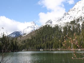
Jagged peaks rising straight from the valley floor, mirrored in the string of lakes at their base.