
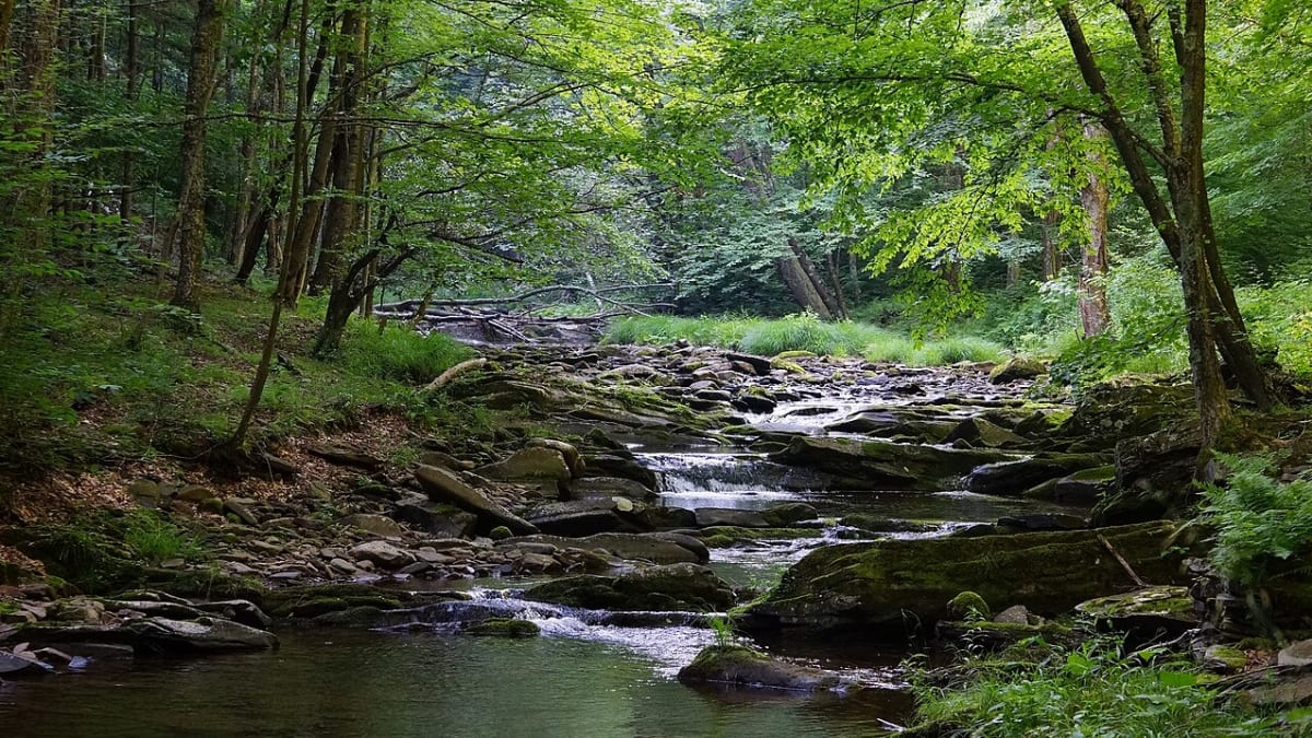
Dolly Sods Wilderness
Blackbird Knob Trail, Davis, WV
Davis, WV
A high plateau above four thousand feet where wind bends the spruce all one direction and the open heath feels more like the far north than the Appalachians.
Dolly Sods is one of the strangest and most beautiful places in the Appalachians, a high plateau above four thousand feet where the forest gives way to open, windswept heath, sphagnum bogs, and stunted spruce whose branches all point one direction, flagged by the constant wind. Standing there, most visitors feel they have somehow been transported to northern Canada rather than the mid-Atlantic.
This landscape is an accident of altitude and history. The high, cold plateau naturally favors a subarctic mix of plants stranded here since the Ice Age, and heavy logging and fires around a century ago stripped the land and helped the open heath expand. The result is a rare, tundra-like world of blueberries, cotton grass, and one-sided spruce, protected today as a federal wilderness.
What Travelers Love
- A landscape of open heath, bog, and wind-flagged spruce unlike anywhere else in the region
- Sweeping views east off the Allegheny Front toward the Potomac Highlands
- Blueberry and huckleberry ripening across the plateau in late summer
- A night sky far from city lights, one of the darkest in the eastern states
Worth Knowing
- This is designated wilderness with rough, often unmarked trails and no facilities, so come prepared and self-reliant
- Weather turns fast and cold at this elevation, so carry layers, rain gear, and a map even on a summer day
- Trails cross bogs and stay wet, so waterproof footwear helps
- Cell service is unreliable to nonexistent, and some old areas still carry warnings from past military use, so stay on established trails
Learn about Dolly Sods Wilderness
A piece of the far north in West Virginia
Dolly Sods sits atop the Allegheny Front, the great eastern edge of the Appalachian Plateau, where the land drops away toward the lower ridges and valleys of the Potomac Highlands. At this height the climate is cold, wet, and windy, and it supports plants and bogs more typical of Canada than of the southern mountains, relics that took hold here during the Ice Age and never left.
The signature sight is the spruce shaped by wind. On the exposed heath, red spruce grow their branches only on the sheltered, downwind side, so that whole stands lean and flag in the same direction like arrows pointing away from the prevailing gales. Between them spread open meadows of heath, huckleberry, cotton grass, and glittering sphagnum bogs, an ecosystem that feels ancient and otherworldly.
How the land was shaped
The word sods is an old regional term for the open, grassy mountain meadows here, and the name is thought to trace to a family that once grazed livestock on the plateau. For generations herders drove cattle up to these high pastures in summer, adding grazing to the natural forces keeping the land open.
The greatest change came around the turn of the twentieth century, when loggers stripped the plateau of its red spruce and the exposed, drained peat soils caught fire and burned deep. Those fires scoured the ground down toward bedrock in places, and the open heath and bog you see today grew back over that damage. The land was later used for military training, and the U.S. Forest Service eventually protected it as the Dolly Sods Wilderness, part of the Monongahela National Forest.
Hiking the plateau
Dolly Sods is a wilderness, which means primitive trails, no signs or amenities to speak of, and a strong dose of self-reliance. Routes cross open heath, thread through spruce islands, follow bog boardwalks in places, and reach viewpoints along the Allegheny Front that look out over ridge after ridge to the east. Many trails are old railroad grades from the logging era, faint and boggy in stretches.
Because the plateau is so exposed, weather is the constant companion here. Fog can drop in minutes, temperatures fall sharply, and even summer afternoons can turn cold and wet. Hikers who come prepared with layers, a map, and waterproof boots are rewarded with solitude and a landscape unlike anywhere else in the East, but the mountain does not forgive the unready.
Wildlife, seasons, and the older land
This high country was part of the ancestral homeland and shared hunting ground of the Shawnee, the Lenape, and other peoples, whose descendant nations continue today beyond West Virginia. The wilderness now shelters black bear, white-tailed deer, snowshoe hare, and a rich variety of birds, including species that breed this far south only in these cold northern-feeling highlands.
The seasons on the plateau are extreme. Late spring and early summer bring wildflowers, blooming laurel, and long days. Late summer ripens blueberries and huckleberries across the open heath. Autumn sets the heath and huckleberry a deep red beneath the flagged spruce, one of the finest fall displays in the state. Winter is fierce, snowy, and often impassable, and the plateau belongs then to the wind.
Closest Boutels
The closest Boutel™ stays, so you can turn this stop into an overnight. Each is a place we chose through independent editorial review, never a paid placement.
Details
Davis, WV
Frequently asked questions
What is the Dolly Sods Wilderness?
The Dolly Sods Wilderness, high in the Allegheny Mountains of eastern West Virginia, is a strikingly unusual and beautiful wilderness area whose high plateau, wind-swept and rugged, resembles the terrain of far-northern Canada more than the typical Appalachian forest. Featuring open heath barrens, bogs, wind-flagged spruce trees, rocky outcrops, sweeping vistas, and rare plants, this high-elevation landscape offers spectacular hiking, backpacking, and scenery, along with berry picking and wildlife. Its otherworldly beauty makes it a beloved destination for adventurous hikers. With its unique high-plateau landscape and rugged trails, the Dolly Sods Wilderness offers a spectacular destination in West Virginia.
What can you do at the Dolly Sods Wilderness?
You can hike and backpack the trails across the open, windswept high plateau, take in sweeping vistas, explore the heath barrens, bogs, and rocky outcrops, pick wild blueberries in season, watch for wildlife and rare plants, and camp in the backcountry, all amid the wilderness's otherworldly scenery. The unique landscape, the vistas, and the backpacking are highlights, especially beautiful in fall. Because it is wilderness, come prepared. With its distinctive high-plateau terrain, trails, and backpacking, the Dolly Sods Wilderness offers a rewarding adventure for prepared hikers in West Virginia.
What should I know before visiting the Dolly Sods Wilderness?
Dolly Sods is a high-elevation wilderness with fast-changing, often harsh weather, so even in summer bring warm layers and rain gear, as it can turn cold, windy, wet, and foggy suddenly. Trails can be rugged, boggy, and poorly marked, so bring a map and navigation, wear sturdy waterproof boots, carry water and supplies, and tell someone your plans. Cell service is unreliable. It is remote, so be self-sufficient. Being well-prepared for the rugged terrain and volatile mountain weather is essential for a safe visit to the Dolly Sods Wilderness in West Virginia.
When is the best time to visit the Dolly Sods Wilderness?
Summer through fall is the prime season, with summer offering the mildest weather and ripe wild blueberries, and fall bringing spectacular color and crisp air, a favorite though the high plateau can be cold and windy any time. Late spring can still be cold and wet. Winter brings deep snow and harsh conditions, for experienced adventurers only. Even summer requires warm layers at the elevation. For the best combination of accessible weather and, in fall, stunning color, aim for summer through fall at the Dolly Sods Wilderness in West Virginia.
What is near the Dolly Sods Wilderness?
The Dolly Sods Wilderness is in the Allegheny Mountains of eastern West Virginia, within reach of Blackwater Falls State Park and Canaan Valley near Davis, the Seneca Rocks area, Spruce Knob, and the high-country mountain region. That makes the Dolly Sods Wilderness a spectacular destination to combine with Blackwater Falls State Park, Seneca Rocks, and the other attractions of eastern West Virginia's high country on a visit to the state.
Nearby
Smoke Hole Caverns
7.1 miles away
The name tells the story: the Smoke Hole country was where Native hunters smoked game and, later, mountaineers ran moonshine into the caves during Prohibition, the rough terrain hiding the smoke.
Canaan Valley Resort State Park
7.4 miles away
The highest large valley east of the Mississippi, a cool 3,200-foot bowl of spruce forest, cranberry bogs, and boreal wetland that feels more like Canada than the mid-Atlantic.

Blackwater Falls State Park
10 miles away
A waterfall the color of dark tea, dropping five stories into a canyon of red spruce and hemlock in the high, cool heart of West Virginia.
The Purple Fiddle
12 miles away
People are startled to find a music room this good in a mountain town of a few hundred.
Seneca Rocks Discovery Center
14 miles away
This is the family-friendly way to take in Seneca Rocks without ropes.

Shenandoah National Park
59 miles away
Cascading waterfalls, blue-hazed ridges, and the 105-mile Skyline Drive along the Blue Ridge Mountains.