
Burt Lake State Park
6635 State Park Dr
Indian River, MI
Two thousand feet of soft sand on one of Michigan's biggest inland lakes, right where the Sturgeon River joins the fabled Inland Waterway.
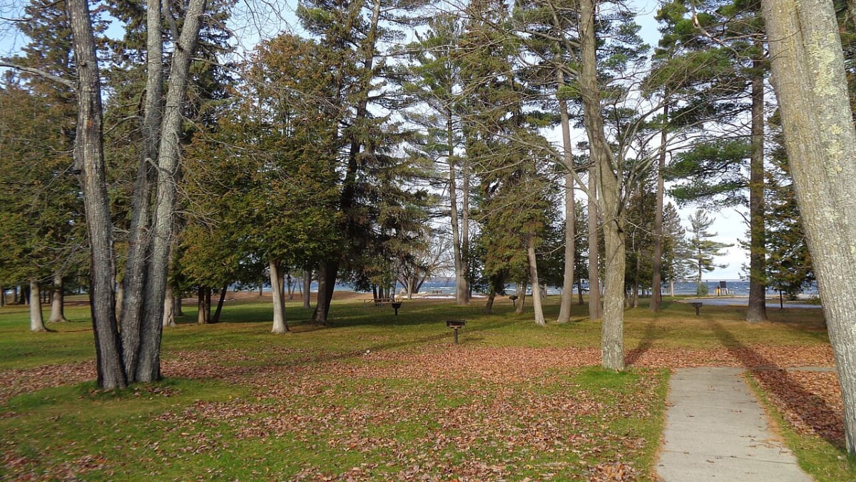
Burt Lake State Park is one of Michigan's oldest state parks, a modest 125 acres that punches far above its size because of what it fronts: two thousand feet of soft, sandy shoreline on Burt Lake, the third-largest inland lake in the state. The bottom shelves out slowly and stays sandy well past where little kids can stand, which is exactly why families have driven up here to swim and camp for a hundred years. Behind the beach, hardwoods shade rows of campsites, and just to the west the Sturgeon River comes rushing in cold and clear from the hills.
The park was among the very first in the system, born in the early 1920s just after Michigan created its State Parks Commission, and it has been drawing summer people ever since. But its real magic is its address. Burt Lake is a link in the Inland Waterway, the roughly forty-mile chain of rivers and lakes that lets a boat travel almost all the way across the top of the Lower Peninsula, from near Lake Michigan to Lake Huron, without ever touching the open Great Lakes.
What Travelers Love
- A long, gently sloping sandy beach with a soft bottom, easy and safe for kids to wade
- Camping right by the water on one of Michigan's largest inland lakes
- A boat launch onto the Inland Waterway, the state's longest chain of lakes and rivers
- Fishing and paddling where the Sturgeon River pours into the lake, and quiet northern sunsets
Worth Knowing
- A Michigan Recreation Passport is required to enter, added to your license plate or bought at the gate
- The lake is big and open, so watch the wind and afternoon chop if you are out in a small boat or on a paddleboard
- The Sturgeon River that meets the lake here is one of the fastest-flowing rivers in the Lower Peninsula, cold and strong, so respect the current
- The village of Indian River is a short drive away for gas, groceries, and a bite, since services at the park itself are limited
Learn about Burt Lake State Park
A beach on Michigan's Inland Waterway
The Inland Waterway is Michigan's longest connected chain of lakes and rivers, running close to forty miles from Crooked Lake down through the Crooked River, across Burt Lake, along the Indian River, over big Mullett Lake, and out the Cheboygan River to Lake Huron. Long before it carried summer cruisers, it was a shortcut. Native travelers, and later French voyageurs and fur traders, used this string of water to avoid the long, dangerous paddle around the tip of the mitt, portaging the few short gaps between one lake and the next.
Burt Lake State Park sits right on that route, at the point where the fast, cold Sturgeon River joins the lake. From the park's boat launch you can put in and, in theory, follow the water all the way to the Great Lakes at either end. For most visitors the waterway simply means big, beautiful water in every direction, sheltered from the moods of Lake Michigan and Lake Huron but connected to both.
The lake itself is large and clean and cold enough to hold walleye, perch, smallmouth bass, and northern pike, and anglers work the mouth of the Sturgeon River where the moving water pulls fish in. On a calm evening the whole surface goes to glass and the sunset spreads clear across it, the kind of northern-lake stillness that keeps the same families coming back to the same campsites summer after summer.
One of Michigan's first state parks
Michigan created its State Parks Commission in 1919, and within a year or two it began assembling a system of public lakeshores and forests for a state that was falling in love with the automobile and the weekend drive. Burt Lake was one of the first sites secured, its land purchased beginning in 1920 and added to through the 1930s, making it one of the original handful of Michigan state parks and one of the oldest still in operation.
The timing was deliberate. As cars put the northern lakes within a day's drive of Detroit and the industrial cities downstate, the state moved to keep the best stretches of shoreline in public hands rather than letting them all be bought up for private cottages. That early decision is why, a century later, anyone with a Recreation Passport can still pull off the highway, walk down to two thousand feet of open sand, and swim in Burt Lake for the price of a park pass.
The campground has grown into a full modern facility with hundreds of sites, some tucked under the hardwoods for shade and some out where you can see the water, but the appeal has never really changed: a plain, generous sand beach on a great big lake, kept public on purpose.
The lake's other story: the Burt Lake Burn-out
The lake the park is named for carries a hard history that is worth knowing while you sit on its shore. On a peninsula on the north side of Burt Lake, known as Indian Point, stood the village of the Cheboiganing Band of Ottawa and Chippewa people, the Burt Lake Band, who had lived on the lake for generations. Their village was recognized in federal treaties, and the land was set aside as an Indian preserve meant to remain theirs.
On October 15, 1900, that promise was broken. Acting for a land speculator who claimed the ground for unpaid taxes, the county sheriff evicted the families and burned their village to the ground, dousing the homes in kerosene and setting fire to some nineteen buildings while their owners watched. The event is remembered today as the Burt Lake Burn-out, and the descendants of the band have spent generations seeking justice and federal recognition.
None of this happened at the state park, and the park does not tell the story on the water it looks out over. But the same lake ties them together, and knowing it changes the view a little. The beach is a fine place for a family day, and it is also worth a quiet moment to remember the families who were driven from this same shoreline just before the park was born.
Visiting Burt Lake State Park
The park is easy to reach, just off the interstate at Indian River in the northern Lower Peninsula, roughly halfway between the towns of Petoskey and Cheboygan and a short drive south of the Mackinac Bridge country. A Michigan Recreation Passport gets you in; you can add it to your plate or buy it at the gate. The village of Indian River sits close by for supplies, so you can travel light to the park itself.
Come for the day to swim and picnic on the long sand beach, or stay in the campground and make it a base for the whole waterway. Launch a boat, canoe, or paddleboard onto Burt Lake, fish the mouth of the Sturgeon River, or just plant a chair in the shallows and let the kids splash where the bottom stays sandy and shallow for ages. It is an unfussy, old-fashioned Michigan lake park, and after a century that is exactly the point.
Closest Boutels
The closest Boutel™ stays, so you can turn this stop into an overnight. Each is a place we chose through independent editorial review, never a paid placement.
Details
Indian River, MI
Frequently asked questions
What is Burt Lake State Park?
Burt Lake State Park, in Indian River in northern Michigan, sits on the southeastern shore of Burt Lake, one of the largest inland lakes in the state and a key link in the region's scenic Inland Waterway. The park is known for its lovely sandy beach and clear water, making it a popular spot for swimming, boating, fishing, and camping. With its beautiful lake setting, family-friendly beach, and access to a chain of connected lakes and rivers, it is a beloved northern Michigan destination.
What can you do at Burt Lake State Park?
You can swim and relax on the sandy beach, launch a boat or kayak to explore Burt Lake and the connected Inland Waterway, fish for the lake's abundant walleye, perch, and bass, and camp at the park's popular campground near the water. Picnicking and simply enjoying the beach and lake views are favorites too. The park's combination of a great swimming beach, boating access, and camping makes it a versatile spot for a classic northern Michigan lake vacation.
What is the Inland Waterway at Burt Lake?
The Inland Waterway is a scenic chain of connected lakes and rivers in northern Michigan, one of the longest such waterways in the state, and Burt Lake is one of its major lakes. Boaters can travel for miles through a series of linked lakes and rivers, a historic route once used by Native peoples and early travelers. From Burt Lake State Park, this gives boaters and paddlers access to a beautiful, extended water journey through the northern Michigan landscape.
When is the best time to visit Burt Lake State Park?
Summer is the prime season, when the water is warm enough for swimming, the beach and campground are lively, and boating and fishing are at their best, though it is also the busiest and campsites fill quickly, so reserving ahead is wise. Late spring and early fall are quieter and pleasant for fishing and camping in milder weather. A Michigan Recreation Passport is required for vehicle entry, so bring one for your visit.
What is near Burt Lake State Park?
The park is in Indian River, near the Cross in the Woods shrine with its giant crucifix, the connected lakes and rivers of the Inland Waterway, and the resort country of northern Michigan, with the route north leading toward the Straits of Mackinac and Mackinac Island. The forests, lakes, and small towns of the region surround the area. That makes Burt Lake State Park an easy base or stop for a northern Michigan getaway centered on lakes and the outdoors.
Outside the Park
Cross in the Woods National Shrine
0.2 miles away
Just off I-75 at Indian River, this Catholic national shrine centers on a 55-foot cross cut from a single Oregon redwood, carrying a seven-ton bronze Christ by Michigan sculptor Marshall Fredericks, t...
Call of the Wild Museum
26 miles away
The Call of the Wild Museum in Gaylord is an easy hit with kids, packed with more than 60 dioramas that put Michigan and North American wildlife in lifelike scenes at eye level, from a bear and her cu...

Legs Inn
26 miles away
At the far end of the famous Tunnel of Trees drive stands one of the strangest and most wonderful buildings in Michigan.