

Blue Ridge Parkway
Virginia & North Carolina
Some drives get you from one place to another. The Blue Ridge Parkway is the place. It rides the very spine of the southern Appalachians for 469 miles, a slow ribbon of mountain road that connects Shenandoah National Park in Virginia to the Great Smoky Mountains in North Carolina. There are no trucks, no billboards, no traffic lights, and no hurry. Just overlook after overlook, wave upon wave of blue-hazed ridgelines, and a hand-lettered milepost every mile to tell you how far you have come.
The National Park Service fondly nicknames it America's Favorite Drive, but it holds an official honor too. The parkway is an All-American Road, the highest designation in the national scenic byway system, given only to routes so remarkable they are considered a destination in their own right. Roll it in a single long day or savor it over a week, and it becomes an unforgettable journey to any stay along the mountains, from Roanoke to Asheville to the doorstep of the Smokies.
Learn about Blue Ridge Parkway
The Road
The Blue Ridge Parkway is a two-lane, low-speed mountain road built for looking, not for making time. It runs 469 miles from Rockfish Gap near Waynesboro, Virginia, where Shenandoah National Park and its Skyline Drive leave off, all the way south to Cherokee, North Carolina, at the edge of the Great Smoky Mountains. The speed limit stays at 45 miles per hour or less the whole way, and the road is closed to commercial trucks, so the pace is gentle and the shoulders are quiet. Distances are measured by mileposts, small concrete markers counting up from zero at the north end to 469 at the south, and they are how everyone finds their way to a favorite overlook or trailhead.
The scenery shifts as the road climbs and dips through a huge range of elevation, from a few thousand feet up to more than a mile high. In the north, the Virginia stretch rolls through gentler ridges, pastoral gaps, and old mountain homesteads. As you cross into North Carolina, the mountains grow taller and wilder, the curves tighten, and the road threads high balds, spruce and fir forests, and deep gorges. The highest point on the whole parkway sits near Richland Balsam in North Carolina, at over 6,000 feet, where the air turns cool and the trees look more like Canada than the American South.
What makes the parkway unlike any ordinary highway is how deliberately it was designed. Its curves were laid out to frame the views, its stone bridges and split-rail fences were built to look as if they grew from the land, and hundreds of overlooks were placed exactly where the mountains open up. Waterfalls, wildflower meadows, historic cabins, and hiking trails line the route from end to end. Because there are no gas stations, restaurants, or stores right on the road itself, the parkway feels like a long, unbroken passage through the mountains, with towns waiting just beyond the exits whenever you need fuel or a meal.
How to Get There
Because the parkway is so long, most travelers pick a section and join it near a nearby city rather than driving all 469 miles. Coming from the north, you reach the top of the road at Rockfish Gap near Waynesboro, Virginia, where Interstate 64 crosses the mountains between Charlottesville and Staunton. That is milepost 0, the seam where Shenandoah National Park's Skyline Drive ends and the Blue Ridge Parkway begins.
In central Virginia, the road runs right along the edge of Roanoke, so travelers arriving on Interstate 81 can be on the parkway within minutes of leaving the highway. Farther south, the North Carolina high country is easiest to reach through Boone and Blowing Rock off U.S. Route 321, or near Asheville, where Interstate 40 and Interstate 26 meet and several parkway entrances sit close to the city. The southern end finishes at Cherokee, North Carolina, at the boundary of Great Smoky Mountains National Park.
The parkway crosses dozens of ordinary highways along its route, so you can hop on or off almost anywhere it meets a numbered road. A common plan is to drive one favorite stretch, exit to a town for gas and food, and rejoin the road later. Many people work north to south, starting near Waynesboro or Roanoke and ending near Asheville and the Smokies, though the drive is just as lovely in reverse.
History
The Blue Ridge Parkway was born in the depths of the Great Depression. In the mid-1930s, as part of the public works push under President Franklin Roosevelt, planners set out to build a scenic mountain road linking Shenandoah National Park in Virginia to Great Smoky Mountains National Park in North Carolina. Construction began in 1935 near the Virginia and North Carolina line, and much of the early labor came from New Deal work programs, including the Civilian Conservation Corps, whose young workers shaped the roadbed, planted trees, and built many of the stone walls and overlooks travelers still admire today.
Building a road along the crest of the mountains was slow, difficult work, and it stretched across more than half a century. The route was pieced together section by section, delayed by two world wars, tight budgets, and the sheer challenge of the terrain. For decades the parkway was nearly finished except for one stubborn gap. The final and most famous piece was the Linn Cove Viaduct, a graceful curving bridge around the rugged flank of Grandfather Mountain, which at last connected the whole road when it opened in 1987, 52 years after the first shovel of dirt.
The parkway has always been managed by the National Park Service rather than a state highway department, which is why it feels so different from a normal road. It was designed as a park stretched thin and long, a protected corridor where the goal is the drive itself. That care earned it national recognition. On September 19, 1996, the Federal Highway Administration named the Blue Ridge Parkway an All-American Road, the top honor in the country's scenic byway system, reserved for routes with scenery and features so exceptional that the road is a destination all its own.
Along the way, the parkway also preserved a vanishing world. As engineers laid out the route, they folded in old mountain homesteads, gristmills, split-rail fences, and log cabins, keeping alive the look and story of southern Appalachian life. Places like Mabry Mill and the Humpback Rocks pioneer farm were saved as living reminders of the families who worked these ridges long before any road ran along them. Today the parkway is one of the most visited units in the entire National Park System, loved as much for that heritage as for its endless blue views.
Little-Known Facts
- The Blue Ridge Parkway is one of the most visited sites in the entire National Park System, often drawing more visitors in a year than any national park, thanks to how easy it is to hop on and off.
- It took 52 years to finish. Construction began in 1935, but the final piece, the Linn Cove Viaduct around Grandfather Mountain, did not open until 1987.
- The Linn Cove Viaduct was built from the top down. Its concrete segments were cast off-site and lowered into place from the finished part of the bridge, so almost no heavy equipment ever touched the fragile mountainside below.
- There are no gas stations, no restaurants, and no stores directly on the parkway. Every service you need waits in the towns just off the exits, which is part of why the drive feels so untouched.
- Commercial trucks are banned for the entire 469 miles, and the speed limit never rises above 45 miles per hour, a deliberate choice to keep the road quiet and unhurried.
- Mabry Mill, near milepost 176 in Virginia, is often called the most photographed spot on the whole parkway. Its water-powered gristmill mirrored in a still pond is a classic autumn postcard.
- Much of the parkway's stonework, tree planting, and early construction was done by the Civilian Conservation Corps, young men put to work during the Great Depression under the New Deal.
- The highest point on the parkway sits near Richland Balsam in North Carolina at over 6,000 feet, where cool-weather spruce and fir forests grow that feel more like Canada than the American South.
- The parkway connects two national parks like bookends, starting where Shenandoah's Skyline Drive ends in the north and finishing at the edge of Great Smoky Mountains National Park in the south.
Along the Route: Virginia
Humpback Rocks
Near the north end of the parkway, Humpback Rocks is a steep half-mile climb to a bare rock outcrop with a sweeping view over the Shenandoah Valley. It is one of the first great overlooks travelers reach coming south from Waynesboro, and the effort pays off with a wide-open panorama. At the base sits a pioneer farm museum, a cluster of reconstructed log buildings that shows how mountain families lived long before the road arrived.
Peaks of Otter
The Peaks of Otter are three rounded mountains rising above a small lake and a historic lodge, one of the most beloved stops in the Virginia stretch. A shuttle bus or a steep hiking trail carries you to the bald summit of Sharp Top, where the view stretches for miles in every direction. The calm lake below, ringed by an easy walking path, is a favorite spot to rest, picnic, and watch the mountains reflect on the water.
Rocky Knob
Rocky Knob is a high recreation area in southern Virginia known for cool breezes, big views, and the dramatic Rock Castle Gorge that drops away below it. Trails here range from short overlook strolls to a long, rugged loop down into the gorge and back. It is a quieter, less crowded stretch of the parkway, good for stretching your legs and taking in the ridgelines rolling off toward the horizon.
Mabry Mill
Mabry Mill is the most photographed spot on the entire parkway, a water-powered gristmill and blacksmith shop reflected in its own quiet millpond. Built by Ed and Lizzie Mabry in the early 1900s, it has been preserved along with a small collection of old mountain buildings and craft demonstrations. In autumn, when the surrounding trees blaze red and gold above the still water, it becomes one of the most classic images in all of Virginia.
Blue Ridge Music Center
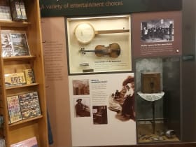
Near the Virginia and North Carolina line, the Blue Ridge Music Center celebrates the old-time and bluegrass music born in these mountains. There is an indoor museum tracing the roots of Appalachian string-band music, plus an outdoor amphitheater set against the ridges where live performances ring out in the warmer months. Even passing through, you can often catch musicians playing informally, a fitting soundtrack to this stretch of the drive.
Along the Route: North Carolina
Grandfather Mountain and the Linn Cove Viaduct
The Linn Cove Viaduct is the parkway's most famous piece of engineering, an S-shaped concrete bridge that curls gracefully around the rugged shoulder of Grandfather Mountain. It was the very last section of the entire road to be completed, opening in 1987 and finally joining the parkway end to end. Grandfather Mountain itself towers above, one of the tallest and most rugged peaks in the Blue Ridge, and a short walk from the visitor center leads to a striking view of the viaduct sweeping through the trees.
Linville Falls
Linville Falls is a powerful two-tier waterfall that plunges over rock ledges and down into the rugged depths of Linville Gorge, one of the wildest canyons in the eastern United States. Several trails of different lengths lead to overlooks, some easy and some steep, each framing the falls and the gorge from a different angle. It is one of the signature natural stops on the North Carolina stretch, a short walk from the parkway to real backcountry drama.
Mount Mitchell
A short spur road off the parkway climbs to the summit of Mount Mitchell, the highest peak east of the Mississippi River at nearly 6,700 feet. The air up top is cool and often cloud-wrapped even in the middle of summer, with a spruce and fir forest that feels distinctly northern. An observation deck at the summit offers a vast, humbling view over ridge after ridge of the southern Appalachians when the weather clears.
Craggy Gardens
Craggy Gardens is a stretch of high, grassy mountain balds famous for exploding into purple rhododendron bloom in June. A short trail leads through gnarled, wind-sculpted trees to a windswept overlook with big views over the folded mountains around Asheville. Even outside bloom season, the cool, misty ridgetops and twisted greenery give this stop an otherworldly feel, unlike anywhere else on the road.
Waterrock Knob
Near the southern end of the parkway, Waterrock Knob is a mile-high overlook with one of the most sweeping views on the whole road, range after range of the Great Smokies fading into blue haze. A short but steep trail climbs to the summit, and the visitor area is a beloved spot to watch the sunset paint the endless ridgelines. It is a fitting grand finale before the parkway drops toward Cherokee and the Smokies beyond.
Details
Southern Appalachians
Frequently asked questions
When was the Blue Ridge Parkway designated an All-American Road?
The Blue Ridge Parkway was named an All-American Road by the Federal Highway Administration on September 19, 1996. That is the highest honor in the national scenic byway system, reserved for routes so remarkable they are considered a destination in their own right. The road itself was begun back in 1935 and took until 1987 to fully complete, when the Linn Cove Viaduct connected the last gap.
How long is the Blue Ridge Parkway, and how long does it take to drive?
The parkway runs 469 miles from near Waynesboro, Virginia, to Cherokee, North Carolina. Because the speed limit stays at 45 miles per hour or less and there is so much to stop and see, driving the whole thing straight through takes at least a full long day, roughly ten to twelve hours of driving. Most travelers give it several days, or pick one favorite section rather than the entire route.
What are the must-see stops along the Blue Ridge Parkway?
In Virginia, the highlights include Humpback Rocks near the north end, the Peaks of Otter above their mountain lake, Rocky Knob, and the famous Mabry Mill. In North Carolina, do not miss the Linn Cove Viaduct at Grandfather Mountain, Linville Falls, a spur trip up Mount Mitchell, the rhododendron balds of Craggy Gardens, and the mile-high view from Waterrock Knob near the southern end.
Is the Blue Ridge Parkway free to drive?
Yes. Unlike many national parks, the Blue Ridge Parkway has no entrance fee and no toll. It is completely free to drive its full length, stop at the overlooks, and hike most of the trails. A few attractions reached from the parkway, such as certain private mountain parks or guided sites, may charge their own admission, but the road itself never does.
What is the best time of day and season to drive the Blue Ridge Parkway?
Early morning and the hour before sunset bring the softest light and the deepest blue haze on the ridges. For seasons, autumn is the most famous, when the mountains blaze with color and the crowds are largest. Spring brings wildflowers and blooming rhododendron, and summer is lush and green, though higher elevations stay cool. Winter is quiet and stark, but many sections close in the cold months.
Is the Blue Ridge Parkway open year-round?
Not entirely. The parkway is open in the warm months, but many sections close in winter and during storms, especially the high North Carolina stretches, when snow, ice, and fog make the road unsafe. The National Park Service gates these closed sections and reopens them as conditions allow. Always check the current road status on the park's real-time closure map before you set out, especially from late fall through early spring.
Do you need four-wheel drive to drive the Blue Ridge Parkway?
No. The parkway is a fully paved, well-maintained two-lane road, and any ordinary passenger car handles it easily in good weather. You do not need four-wheel drive or high clearance. The main things to watch are the curves, the steady climbs and descents, and the elevation, so drive at an easy pace and let faster traffic use the pullouts to pass.
What are the winter driving conditions on the Blue Ridge Parkway?
Winter can be harsh at these elevations. Snow, ice, and thick fog are common, especially in the high North Carolina sections, and the Park Service closes many stretches for safety when the weather turns. The road is not always plowed the way a state highway would be, so sections can stay gated for days. If you visit in the cold months, check the parkway's official closure map first and be ready to reroute onto lower valley highways.
Where do you get gas and food on the Blue Ridge Parkway?
There are no gas stations, restaurants, or stores directly on the parkway itself. Fuel and food are found in the towns just off the exits, such as Waynesboro, Roanoke, Boone, and Asheville, so it is smart to fill your tank before a long stretch and plan meal stops around the exits. A handful of seasonal parkway visitor centers and lodges offer limited services, but you should never count on finding fuel on the road.
Is there cell phone service along the Blue Ridge Parkway?
Cell service is spotty and often disappears entirely along the parkway, since much of the road runs through remote, high mountain terrain far from towers. You may catch a signal near overlooks close to cities like Roanoke or Asheville, but expect long stretches with no coverage. Download your maps for offline use, tell someone your plans, and do not rely on your phone for navigation or emergencies once you are deep in the mountains.
Nearby

Blue Ridge Parkway
0.1 miles away
America's Favorite Drive, a 469-mile mountain parkway with no trucks or billboards, running the crest of the southern Appalachians from Shenandoah to the Great Smokies.
Blue Ridge Music Center
28 miles away
Right on the Blue Ridge Parkway, this is where the regions music is honored and, better, actually played.

Rex Theater
29 miles away
For living Galax music with no ticket, this is the spot most passers-through never find.

Virginia Museum of Natural History
31 miles away
A serious natural history museum in a small town is a real find for families.