
Blodgett Canyon Trailhead
Blodgett Camp Rd
Hamilton, MT
Walls of solid granite rising two thousand feet on either side, a short drive from town yet as wild as the deep Bitterroots get.
Blodgett Canyon is the kind of place that makes people stop the car and stare. Cut deep into the eastern wall of the Bitterroot Mountains just west of Hamilton, it is a glacier-carved trench of solid granite, with cliffs rising more than two thousand feet on either side of a clear mountain creek. Locals have long called it the Yosemite of Montana, and standing at the trailhead looking up the canyon, you understand why.
What makes it a gem is how much grandeur it hands you for how little effort. The trail begins right at the canyon mouth and follows Blodgett Creek up the valley on a mostly gentle grade, so you do not have to be a mountaineer to walk into towering big-wall country. Climbers come from around the region to test the granite, but everyone else comes simply to walk beside the water with all that stone leaning overhead.
What Travelers Love
- The sheer granite walls rising more than two thousand feet straight up on both sides of the trail
- A creekside path that stays gentle for miles, so almost anyone can walk into serious mountain scenery
- The waterfall reward a few hours in, where Blodgett Creek pours off the cliffs
- Watching for rock climbers on the big walls and mountain goats on the high ledges
Worth Knowing
- The walk to the waterfall is a full day out and back, so start early, carry plenty of water, and wear real shoes
- The access road is gravel near the end and the trailhead has a small campground and vault toilet but no other services, so pack in everything you need
- This is grizzly and black bear country, so carry bear spray, make noise, and know how to use it before you go
- Lower stretches burned in a big 2000 wildfire, so parts of the trail run through open, regrowing forest with strong sun and little shade
Learn about Blodgett Canyon Trailhead
A granite canyon carved by ice
The Bitterroot Range is scored with more than two dozen deep canyons along its eastern face, and Blodgett is among the most spectacular. Long ago glaciers ground down through the mountains here and carved this U-shaped trench into the pale granite of the Idaho Batholith, a vast body of ancient rock that forms the spine of the range. The result is a canyon of clean, steep walls, with the lower cliffs standing well over two thousand feet above the creek.
Those walls are the draw for climbers. Blodgett is regarded as one of the finest big-wall climbing areas in Montana, and on a good day you may spot tiny figures inching up routes that run a thousand feet or more of sustained granite. On the higher ledges, mountain goats pick their way along, and the canyon has also served as a nesting site in the effort that brought peregrine falcons back to the Bitterroots after they nearly vanished.
The canyon and creek take their name from Joseph Blodgett, a packer who worked the Bitterroot Valley in the 1860s and later settled along the water that now carries his name. It is a small, human footnote to a landscape that dwarfs any single person, a reminder of the early travelers who moved through these mountains before the roads and towns arrived.
The walk up the creek
From the trailhead at the mouth of the canyon, the trail sets off along Blodgett Creek and keeps to an easy grade for the first few miles, which is exactly what makes it so welcoming. You can turn a stroll of a mile or two into a satisfying outing, resting on the rocks by the water while the granite towers close in above you, or you can push on deeper into the canyon toward the falls.
The classic goal is the waterfall a few hours in, where the creek spills over ledges in a burst of white water, reached by a full-day out-and-back walk. A sturdy footbridge crosses the creek along the way, a fine place to sit and listen to the rush of moving water. Beyond the falls the trail continues for many more miles into the wilderness for backpackers, but most visitors are content with the day hike and the endless views straight up.
In the summer of 2000 a large wildfire swept the lower canyon, burning the forest for a couple of miles above the trailhead. Two decades on, that stretch is a living lesson in how a mountain forest heals, open and sunny with young trees and wildflowers coming back among the silvered snags. It means the first miles offer less shade, so an early start and a full water bottle make the walk far more pleasant.
Visiting Blodgett Canyon
The trailhead lies just a handful of miles west of Hamilton, reached by paved and then gravel roads through the ranch country at the foot of the mountains. There is a small forest-service campground and a vault toilet at the trailhead, but no water beyond the creek and no other services, so bring everything you need and top off in town first. A dry day makes the gravel road and the trail far easier.
This is bear country, both black bears and grizzlies, so carry bear spray where you can reach it, make noise as you walk, and give any wildlife plenty of room. Give yourself a full day if you are aiming for the falls, or just an unhurried hour or two if you only want to taste the canyon. Either way, Blodgett rewards looking up: it is a rare stretch of high alpine drama you can reach on a short drive and a gentle walk, tucked into the Bitterroots for anyone willing to follow the creek.
Closest Boutels
The closest Boutel™ stays, so you can turn this stop into an overnight. Each is a place we chose through independent editorial review, never a paid placement.
Details
Hamilton, MT
Frequently asked questions
What is the Blodgett Canyon Trailhead?
The Blodgett Canyon Trailhead, near Hamilton in Montana's Bitterroot Valley, is the gateway to one of the most beautiful canyons in the Bitterroot Mountains, a dramatic glacier-carved gorge of towering granite walls, forest, and a rushing creek. From the trailhead, a scenic trail leads into the canyon beneath soaring rock cliffs that rise thousands of feet, past a lovely creek and, farther in, waterfalls, offering everything from an easy stroll to a longer hike into the wilderness. The stunning granite walls make it a favorite of hikers, photographers, and rock climbers. A spectacular slice of the Bitterroot backcountry, it rewards those who venture in. With its dramatic canyon scenery, Blodgett Canyon offers a breathtaking destination in Montana.
What can you do at Blodgett Canyon?
You can hike the trail into the canyon beneath towering granite walls, enjoy the rushing creek and forest, go farther to reach waterfalls, watch for wildlife, and take in some of the finest mountain scenery in the Bitterroots, with rock climbing on the great cliffs for the experienced. The dramatic granite walls, the creekside trail, the waterfalls deeper in, and the wilderness scenery are the draws, offering hikes for a range of abilities. The soaring cliffs are unforgettable. With its trails and scenery, Blodgett Canyon offers a rewarding experience in Montana.
What should I know before hiking at Blodgett Canyon?
Blodgett Canyon is in bear country in the Bitterroot Mountains, so carrying bear spray, making noise, and storing food properly are important, and the trail can be long if you venture deep into the canyon, so bringing plenty of water, sturdy footwear, and layers, and turning back with enough daylight, all matter. Mountain weather can change quickly, and the terrain becomes rugged farther in, so knowing your limits and staying on the trail are wise. Checking current trail and weather conditions before you go helps. Preparing well ensures a safe, rewarding hike at Blodgett Canyon in Montana.
When is the best time to visit Blodgett Canyon?
The warmer months of late spring through fall are the best time to hike Blodgett Canyon, when the trail is clear of snow, the creek and any waterfalls are flowing, and the weather is mild, with fall bringing lovely color to the canyon, while winter snow and ice make the trail difficult. Because conditions vary, checking current trail and weather reports before you go is wise. For clear trails and the best scenery, aim for late spring through fall at Blodgett Canyon in Montana.
What is near the Blodgett Canyon Trailhead?
The Blodgett Canyon Trailhead is near Hamilton in Montana's Bitterroot Valley, within reach of Hamilton, the Daly Mansion, the Bitterroot River and its other canyons, and the routes toward Missoula to the north. That makes Blodgett Canyon a breathtaking stop to combine with the Daly Mansion and the other attractions of the Bitterroot Valley on a visit to Montana.
Nearby
Daly Mansion
5.6 miles away
The Daly Mansion is the 50-room Georgian-revival summer estate of Copper King Marcus Daly, preserved as a public historic site on 46 wooded acres north of Hamilton in the Bitterroot Valley.
Lee Metcalf National Wildlife Refuge
20 miles away
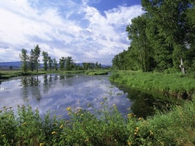
A quiet Bitterroot River bird refuge of ponds, marsh, wet meadow, and cottonwood forest, walled by the Bitterroot and Sapphire Mountains.
Selway-Bitterroot Wilderness, Moose Creek Ranger District
25 miles away
The Selway-Bitterroot Wilderness covers 1.3 million acres on the Idaho-Montana border, the second-largest wilderness in the contiguous United States.