
Trail Ridge Road
Trail Ridge Road, Rocky Mountain National Park
Estes Park, CO
A road to the roof of the Rockies, running for miles across the tundra above 12,000 feet.
Trail Ridge Road is one of the great drives in America, the highest continuous paved road in any national park in the country. Winding across Rocky Mountain National Park, it climbs above 12,000 feet and crosses the Continental Divide, carrying visitors up into a world above the trees.
For miles the road runs across open alpine tundra, a fragile, wind-swept landscape of tiny wildflowers, cushion plants, and scurrying marmots and pikas, with overlooks that take in an ocean of snow-capped peaks. It is a chance to reach the roof of the Rockies from the comfort of your car, open only during the warm months when the deep snow has been plowed clear.
What Travelers Love
- Driving above the treeline across open alpine tundra
- Overlooks with views of range after range of snow-capped peaks
- Marmots, pikas, and elk in the high meadows
- The Alpine Visitor Center, the highest in the National Park Service
Worth Knowing
- The high stretch is seasonal, generally open from late spring through fall
- It sits inside Rocky Mountain National Park; entry reservations may apply in summer
- It climbs above 12,000 feet, so the thin air and fast weather demand caution
- The tundra is fragile, so stay on trails and pullouts and never walk off-trail
Learn about Trail Ridge Road
Above the trees
As Trail Ridge Road climbs, the forest thins and finally gives way to tundra, the same kind of treeless landscape found in the Arctic. This alpine world survives a brutal climate, and its plants grow low and slow, some living for decades, which is why staying on the trails and pullouts to avoid trampling them matters so much.
Numerous overlooks line the road, each with a sweeping view, and short paved trails like the one at Rock Cut let visitors walk a little way into the tundra. The Alpine Visitor Center, the highest facility in the National Park Service, sits near the top.
Driving the road
The full road runs about 48 miles between Estes Park and Grand Lake, crossing the park and the Continental Divide. Because of the altitude and the exposure, the high section is closed by snow for much of the year and typically opens from late spring through fall, with the exact dates depending on snow clearing.
Weather can change in minutes up high, with sun, wind, and sudden storms, so layers and caution are essential, and afternoon thunderstorms are common in summer. Taken slowly, with stops at the overlooks, it is an unforgettable journey to the top of the Rockies.
Closest Boutels
The closest Boutel™ stays, so you can turn this stop into an overnight. Each is a place we chose through independent editorial review, never a paid placement.
Details
Estes Park, CO
Frequently asked questions
What is Trail Ridge Road?
Trail Ridge Road is the highest continuous paved road in any national park in the United States, crossing Rocky Mountain National Park in Colorado between Estes Park and Grand Lake. It climbs above 12,000 feet and traverses the Continental Divide, carrying visitors up above the treeline into a landscape of open alpine tundra. Along the way, overlooks offer sweeping views of snow-capped peaks, and wildlife such as marmots, pikas, and elk are often seen. Considered one of the great mountain drives in America, Trail Ridge Road lets travelers experience the roof of the Rockies from their car, though its high stretch is open only in the warm months.
When is Trail Ridge Road open?
The high portion of Trail Ridge Road is seasonal, generally open from late spring, around Memorial Day, through mid-fall, though the exact dates vary from year to year depending on snow. Because it climbs above 12,000 feet, deep snow closes the road for much of the year, and it does not reopen until crews have plowed it clear, which can take weeks. Even in summer, the road can close temporarily for snow or storms. So it is important to check the current status of Trail Ridge Road before you plan to drive it, and to be prepared for rapidly changing high-altitude weather whenever you go.
How high does Trail Ridge Road go?
Trail Ridge Road climbs to a maximum elevation of over 12,000 feet, with about eleven miles of the road running above the treeline across alpine tundra. That makes it the highest continuous paved road in the US national park system. At these elevations the air is thin, the weather is extreme and fast-changing, and the alpine environment is fragile, so visitors should take the altitude seriously, bring warm layers even in summer, stay on established trails and pullouts to protect the tundra, and watch for afternoon thunderstorms. The reward is a rare chance to stand on the roof of the Rockies surrounded by an ocean of peaks.
Is Trail Ridge Road hard to drive?
Trail Ridge Road is a well-maintained paved road, but it is a serious mountain drive that calls for attention. It climbs high and fast, with sections that run along exposed ridges with steep drop-offs and few guardrails, which can be unnerving for some drivers, and the thin air and possible weather add to the challenge. There are no extreme grades or unpaved sections, but driving slowly, using pullouts to let faster traffic pass and to enjoy the views, and watching for weather and wildlife all make for a safer, more enjoyable trip. Taken at a relaxed pace with plenty of stops, it is a spectacular experience.
Nearby
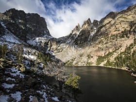
Emerald Lake
6.1 miles away
Emerald Lake is one of the classic day hikes in Rocky Mountain National Park, a moderate trail from Bear Lake that passes two other lovely lakes, Nymph and Dream, on its way to a stunning green-tinged...
Bear Lake
6.4 miles away
Bear Lake is the beloved hub of Rocky Mountain National Park, a small subalpine lake ringed by pines and towering peaks at about 9,500 feet.
Alberta Falls
7.2 miles away
Alberta Falls is a popular, easily reached waterfall in Rocky Mountain National Park, where Glacier Creek tumbles about 30 feet through a rocky gorge.