
South Yuba River State Park
17660 Pleasant Valley Rd
Penn Valley, CA
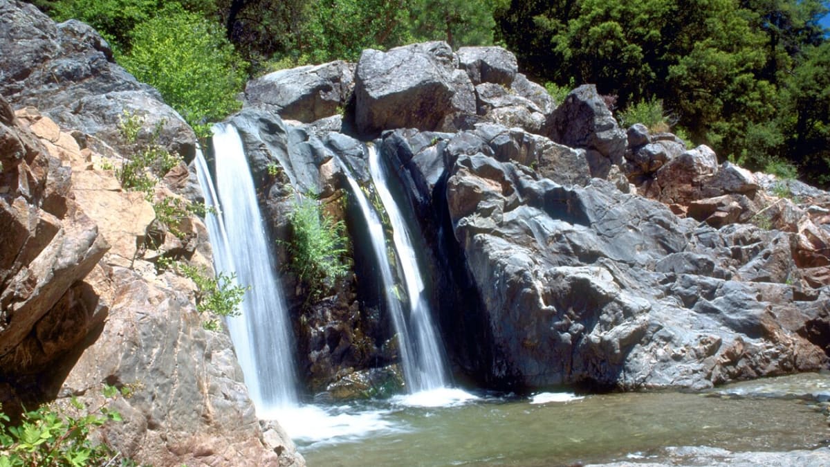
A Gold Rush river of emerald swimming holes and granite canyons, spanned by the longest single-span covered bridge in the world.
South Yuba River State Park protects a stretch of one of the Sierra's most beautiful rivers, a run of clear green pools, granite slides, and canyon trails cutting through the foothills of Gold Country. In summer the swimming holes draw people from all over Northern California, and in spring the canyon slopes light up with one of the region's best wildflower shows.
Its centerpiece is a piece of history. At Bridgeport, a graceful covered bridge crosses the river, and at roughly 230 feet it is the longest single-span covered wooden bridge in the world. Built in 1862 during the Gold Rush, it carried freight and travelers on the road to the Nevada silver mines, and it still stands, painstakingly restored, over the water it has watched for more than a century and a half.
What Travelers Love
- The Bridgeport Covered Bridge, the longest single-span covered wooden bridge in the world
- Emerald green swimming holes and granite ledges along the river in summer
- Wildflower displays that carpet the canyon slopes in spring
- Trails along a wild river running through Gold Rush history
Worth Knowing
- The river runs cold and fast, especially during spring snowmelt, and its currents have proven dangerous, so pick your swimming spots carefully
- Summer weekends are busy and parking fills, so arrive early for the popular swimming areas
- Poison oak is common along the trails, so learn to spot it and stay on the path
- Foothill summers are hot, so bring water and sun protection
Learn about South Yuba River State Park
The Bridgeport Covered Bridge
The Bridgeport Covered Bridge was constructed in 1862 by the Virginia Turnpike Company as part of a toll road linking the Sacramento Valley to the mines. It is the last remaining single-span covered wooden bridge of its size in the nation, built with Douglas-fir trusses and wrought-iron rods and roofed in sugar-pine shakes to protect the timbers from the weather.
The bridge was a vital artery during the Gold Rush and the Nevada silver boom that followed, carrying wagons, freight, and travelers across the South Yuba. After years of careful engineering and restoration to save its aging timbers, it remains open to visitors, one of the most photographed structures in Gold Country.
Gold, the river, and the land it scarred
Gold was discovered near Rose's Bar, just downstream of Bridgeport, in 1848, and within two years thousands of miners swarmed the river. The Gold Rush transformed this country almost overnight, and the scars of hydraulic mining, which blasted whole hillsides apart with water cannons, are still visible upstream at places like Malakoff Diggins.
The South Yuba itself runs clear and cold out of the high Sierra, carving pools and polished granite through a steep canyon. What was once an industrial workhorse of the mining era is now valued for exactly the wildness that survived it.
The Nisenan homeland
Long before the miners, this was and remains the homeland of the Nisenan people, who lived closely with the river, fishing its salmon runs, hunting the foothills, and using native plants for food, medicine, tools, and textiles. The Gold Rush was catastrophic for them, bringing disease and violence that shattered communities.
The park formally acknowledges the Nisenan as the original and ongoing inhabitants of this land, and their descendants remain part of the region today.
Swimming, wildflowers, and when to go
In late spring the canyon slopes explode with wildflowers, one of the finest displays in the foothills, and the river runs high and cold with snowmelt. By summer the flow drops and the emerald pools warm enough for swimming, drawing crowds to spots like the Bridgeport and Highway 49 areas. Fall is quiet and golden, and winter brings a rushing, dramatic river.
The river demands respect. Its currents run strong, especially in spring, and have caused drownings, so choose calm, shallow pools and never dive into water you cannot see the bottom of. Come early on hot weekends, carry water, and watch for poison oak along the trails.
Closest Boutels
The closest Boutel™ stays, so you can turn this stop into an overnight. Each is a place we chose through independent editorial review, never a paid placement.
Details
Penn Valley, CA
Frequently asked questions
What is South Yuba River State Park?
South Yuba River State Park, in the Sierra Nevada foothills of California's Gold Country near Nevada City, protects a beautiful stretch of the South Yuba River known for its crystal-clear water, granite pools, swimming holes, and scenic canyon. The park is also home to the historic Bridgeport Covered Bridge, one of the longest single-span wood-covered bridges in the country. With hiking trails along the river and through wildflower-covered slopes, refreshing swimming spots, and rich history, South Yuba River State Park offers a wonderful blend of natural beauty, recreation, and heritage in the scenic Gold Country foothills.
What can you do at South Yuba River State Park?
You can hike scenic trails along the river and canyon, including routes famous for spectacular spring wildflowers, swim and cool off in the clear pools and swimming holes in summer, see the historic Bridgeport Covered Bridge, picnic, fish, and enjoy the beautiful river scenery. The trails range from easy riverside walks to more strenuous routes. Wildflower viewing in spring is a highlight. With its swimming, hiking, wildflowers, and historic covered bridge, South Yuba River State Park offers a rewarding mix of nature, recreation, and history in California's Gold Country foothills.
What safety precautions should I take at the South Yuba River?
The river can be dangerous, especially in spring and early summer when snowmelt makes the current swift and cold, so swim only in calm, shallow areas during low, warm-water conditions, never dive into unknown depths, and be extremely cautious of fast water, slippery rocks, and cold temperatures that can cause hypothermia and swift-water accidents, which have been fatal. Watch children closely, and heed any posted warnings. On the trails, watch for poison oak and rattlesnakes. Respecting the river's power, especially during high flows, is essential for a safe visit.
When is the best time to visit South Yuba River State Park?
Spring is spectacular for the famous wildflowers along the trails and green scenery, though the river runs high, cold, and dangerous then, so swimming is unsafe. Summer is best for swimming in the pools once the water calms and warms, though it can be hot. Fall is pleasant and quieter. For wildflowers and hiking, aim for spring, and for safe swimming, wait for summer's lower, warmer water. Whatever the season, respecting the river conditions and choosing activities accordingly ensures the best and safest experience at this beautiful park.
What is near South Yuba River State Park?
The park is near the historic Gold Rush towns of Nevada City and Grass Valley in California's Gold Country, with the Empire Mine, the Malakoff Diggins hydraulic mining site, and Scotts Flat Lake nearby, and the Sierra Nevada and Lake Tahoe within a drive to the east. That makes South Yuba River State Park a beautiful natural stop to combine with Nevada City, Grass Valley, the Gold Country mining sites, and the scenery of California's Sierra foothills on a Northern California visit.
Outside the Park
Scotts Flat Lake
4.0 miles away
A pine-ringed mountain reservoir in the Tahoe National Forest above Nevada City, with clear water, sandy swimming coves, boat ramps, and two lakeside campgrounds tucked among the ponderosa.
Malakoff Diggins State Historic Park
6.0 miles away
Malakoff Diggins is the scar left by the largest hydraulic gold mine in the world.

Empire Mine State Historic Park
7.4 miles away
Empire Mine State Historic Park in Grass Valley, 5 miles south of Nevada City, preserves the 367-acre estate and mining complex of the Empire Mine, which produced 5.8 million ounces of gold over 106 y...