
Fort Bowie National Historic Site
3500 S Apache Pass Rd, Bowie, AZ
Bowie, AZ
The quiet adobe ruins of a frontier army fort at Apache Pass, reached only on foot down a trail that leads through the heart of the Apache Wars.
Fort Bowie National Historic Site preserves the ruins of a frontier army fort at Apache Pass, a strategic gap between two mountain ranges in southeastern Arizona. There is no road to the fort itself: visitors walk a trail of about a mile and a half in, passing a stage station, a cemetery, the vital spring, and the site of a famous battle before reaching the melting adobe walls of the post. The approach on foot is part of what makes the place so powerful.
Apache Pass mattered because of its water. The spring here was one of the few reliable sources in a dry land, which made the pass a crossroads for Apache people, emigrants, and the army alike, and a place of intense conflict during the long wars between the United States and the Chiricahua Apache. Fort Bowie stood at the center of that history, and its quiet ruins today mark ground bound up with the story of Cochise, Geronimo, and the defense of the Apache homeland.
What Travelers Love
- Reaching the fort only on foot, along a trail rich with history
- The atmospheric adobe ruins standing quiet in the grassland
- The spring at Apache Pass that made this ground so contested
- A deep, sobering look at the Apache Wars in the very place they happened
Worth Knowing
- The fort is reached by a walking trail, so wear good shoes and carry water
- It is a remote spot with little shade, so plan for the weather and the heat
- This is sacred and painful ground to the Apache, so treat it with respect
- Summer brings heat and monsoon storms, so hike in the morning
Learn about Fort Bowie National Historic Site
The spring and the Apache Wars
Apache Pass was the homeland of the Chiricahua Apache, and its spring was a place of life in dry country. When emigrants, a stage line, and the army began using the pass in the mid-1800s, tensions rose, and in 1861 a misunderstanding known as the Bascom Affair set off open conflict between the army and Cochise's people. The following year, a large battle was fought here at Apache Pass, prompting the army to build the first Fort Bowie to guard the spring.
For the next quarter century the fort was a hub of the campaigns against the Chiricahua Apache, and it was from here that the army coordinated the long pursuit that ended in 1886 with the surrender of Geronimo, one of the last Apache leaders to hold out. That surrender marked the end of the Apache Wars, after which many Chiricahua, including Geronimo, were sent into exile far to the east. The Chiricahua Apache endure today as a living people, and Fort Bowie stands as a memorial to a hard chapter of their history.
Walking into history
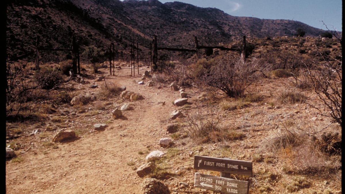
The only way to reach the fort is on foot, along a trail that winds through the pass and past the landmarks of its story. Along the way the trail passes the ruins of the Butterfield stage station, the post cemetery with its weathered markers, the site of the 1862 battle, and the Apache Pass spring that made the ground so contested.
At the end stands the fort itself, its adobe walls slowly melting back into the earth, with a small visitor center and interpretive signs explaining what once stood there. The walk is not long, but it carries you through the whole layered history of the pass, and the quiet, remote setting lends the ruins a haunting stillness that a roadside stop could never match.
The land around the pass
Fort Bowie sits in high desert grassland between the Chiricahua and Dos Cabezas mountains, part of the sky-island country where forested ranges rise from open plains. The pass and its spring create a pocket of greenery and water in a dry land, drawing birds and wildlife to the site.
The grassland and surrounding foothills support hawks, quail, songbirds, and a variety of desert reptiles and mammals, from javelina and coyote to jackrabbit and mule deer. Spring wildflowers and the greening that follows summer rains bring color to the pass, and the wide, quiet landscape gives a sense of the country as it looked when the fort was active.
Season by season
Spring is mild and often green, with wildflowers along the trail, one of the most comfortable times to make the walk in. Summer is hot and largely shadeless, so an early start and plenty of water are essential, and the July and August monsoon can bring sudden afternoon storms.
Fall brings warm days, cool nights, and thinner crowds, an excellent season to visit the quiet ruins. Winter is cool and clear, with cold nights and bright, pleasant days for the trail, and the occasional dusting of snow on the mountains framing the pass.
Closest Boutels
The closest Boutel™ stays, so you can turn this stop into an overnight. Each is a place we chose through independent editorial review, never a paid placement.
Details
Bowie, AZ
Frequently asked questions
What is Fort Bowie National Historic Site?
Fort Bowie National Historic Site, in the remote Apache Pass of southeastern Arizona, preserves the evocative ruins of a frontier army fort central to the conflicts between the U.S. Army and the Chiricahua Apache, including Cochise and Geronimo, in the mid-to-late nineteenth century. Reached by a scenic foot trail, the site includes the adobe fort ruins, a historic stage station, a cemetery, and Apache Spring, all set in a rugged, historically charged landscape. Quiet and moving, Fort Bowie offers a reflective look at a pivotal and difficult chapter of the American frontier.
How do you get to Fort Bowie?
Reaching the heart of Fort Bowie requires a hike, as there is no direct road to the main ruins and visitor center; instead, a trail of roughly a mile and a half each way leads from the trailhead past historic features including the Butterfield stage station ruins, the cemetery, and Apache Spring to the fort ruins and visitor center. This walk through the historic Apache Pass is part of the experience. Wear good shoes, carry water, and allow time for the round-trip hike to fully appreciate the site.
What can you see at Fort Bowie?
Along the trail and at the site, you can see the adobe ruins of the fort, the remains of a Butterfield Overland Mail stage station, a frontier cemetery, the ruins of an Apache agency, and Apache Spring, the vital water source that made the pass strategically important. A visitor center offers exhibits and context on the Apache Wars, Cochise, Geronimo, and life at the fort. Interpretive signs along the walk tell the layered story. The remote setting and evocative ruins make for a powerful and contemplative visit.
When is the best time to visit Fort Bowie?
Because visiting involves a hike of about three miles round trip in exposed country, the cooler months from fall through spring are most comfortable, while summer is hot, so an early start with plenty of water is essential then. Mornings offer cooler temperatures and softer light. This is a remote area with limited services, so bring supplies and check conditions. Wear sturdy shoes and sun protection whenever you go. The milder months make the walk and exploration of the ruins most enjoyable.
What is near Fort Bowie National Historic Site?
Fort Bowie is in Apache Pass in southeastern Arizona, near Willcox and the spectacular Chiricahua National Monument, with the Cochise Stronghold, the birding areas around Whitewater Draw and Willcox Playa, and the wine country of Willcox within reach, and Tombstone and Bisbee farther southwest. That makes Fort Bowie a moving historical stop to combine with the rock spires of Chiricahua, the sky-island scenery, birding, and wineries of southeastern Arizona's remote and history-rich landscapes.
Nearby
Chiricahua National Monument
11 miles away
Chiricahua National Monument preserves rhyolite tuff formations shaped by 27 million years of erosion into columns, fins, and boulders balanced on improbably thin pedestals.
Willcox Playa Sandhill Crane Staging
21 miles away
Between late October and February, 20,000-30,000 sandhill cranes roost on the Willcox Playa and disperse to surrounding farmland each morning, returning in waves at sunset.

Cave Creek Canyon
23 miles away
Cave Creek Canyon in the Chiricahua Mountains is considered one of the top 5 birding sites in North America.