
Copper Falls State Park
N Country National Scenic Trail, Mellen, WI
Mellen, WI
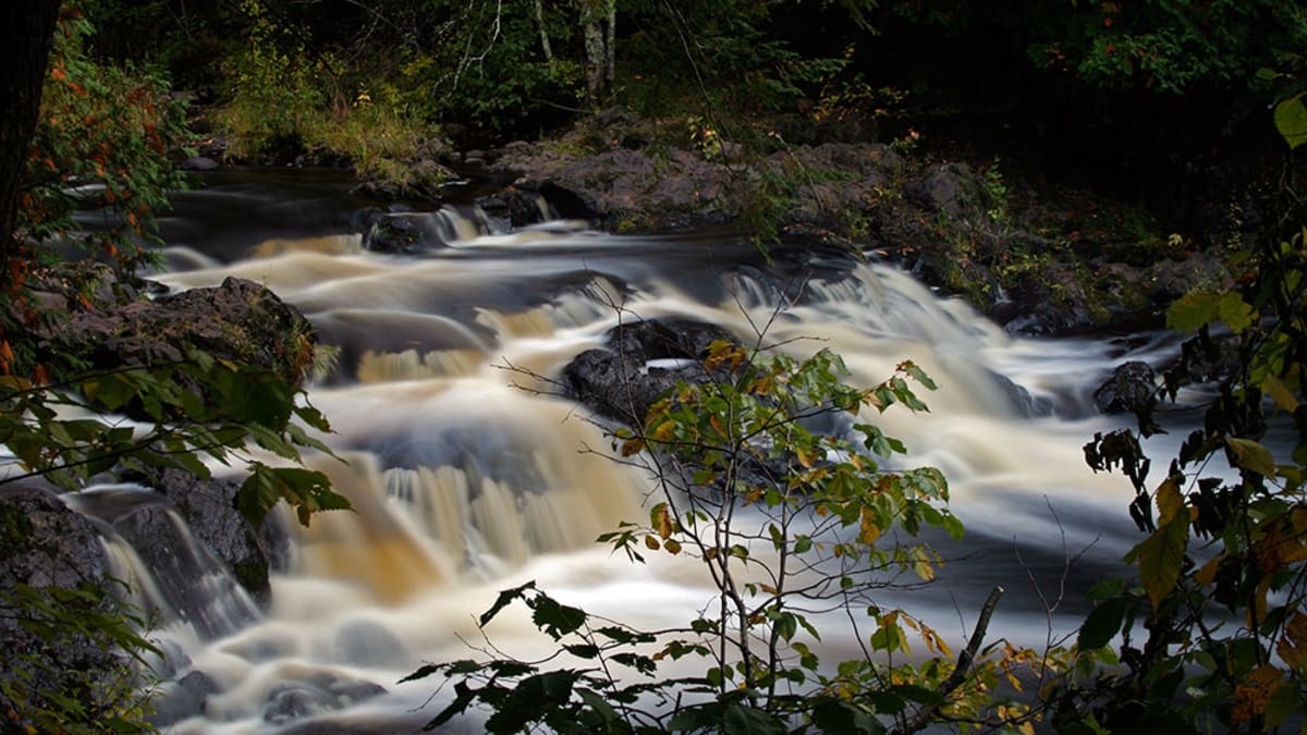
Two rivers pour over dark ancient rock into a deep, tea-colored gorge, walled by cliffs and threaded with log bridges built during the Depression.
Copper Falls State Park is one of the great scenic parks of the Wisconsin Northwoods, built around a deep, rugged gorge where the Bad River and its Tyler Forks tributary pour over a series of waterfalls between dark, ancient rock walls. The water runs a deep tea-brown, stained by the tannins of the bogs and forests upstream, and it drops in falls and cascades through a canyon so steep and rocky it feels almost mountainous, unusual country for the Upper Midwest.
A loop trail follows the rim of the gorge past the main falls and overlooks, crossing the river on rustic log-and-stone bridges. Much of the park's beautiful stonework and log architecture was built during the Great Depression by the Civilian Conservation Corps, whose craftsmanship gives Copper Falls its distinctive, timeless character. It is a place where wild northern rivers, ancient rock, and handmade history all come together.
What Travelers Love
- The deep, dramatic gorge with waterfalls dropping between dark rock walls
- The tea-brown water of the Bad and Tyler Forks rivers, stained by northern bogs
- Historic log-and-stone bridges and buildings built by Depression-era crews
- A well-marked loop trail linking several falls and overlooks
Worth Knowing
- Stay on the trails and behind railings, as the gorge walls are sheer and the rock can be slick
- Spring runoff makes the falls loudest and fullest
- The park is open year-round, but trails and overlooks can be icy in the cold months
- The North Country National Scenic Trail passes through, for those wanting a longer hike
Learn about Copper Falls State Park
The gorge and the ancient rock
The dark rock of the gorge is some of the oldest exposed stone in the region, part of the ancient volcanic and lava formations laid down more than a billion years ago when the North American continent was pulling apart along the great rift that created the Lake Superior basin. Long afterward, the region carried a history of copper in its rocks, and small-scale copper mining once drew prospectors here, giving the falls their name.
The gorge itself was carved as the Bad River and Tyler Forks cut down through that hard rock, aided over the ages by the grinding of glaciers and the rush of meltwater. The result is a steep, narrow canyon walls of dark stone, far deeper and more rugged than most Wisconsin rivers manage, where the tea-colored water drops in a sequence of falls and cascades on its way toward Lake Superior.
Northwoods and Ojibwe country
This is Ojibwe country, part of the homeland of the Anishinaabe, whose Bad River Band lives nearby and whose reservation lies downstream where the Bad River reaches Lake Superior. The river and its watershed hold deep importance to the Bad River people, who have long fished, harvested wild rice, and cared for these waters, and who remain present and active stewards of the land today.
The name Bad River is a European rendering of an Ojibwe name for the river, and the whole region carries the layered history of Native life, the fur trade, logging, and small mining ventures. A visit to the falls is a chance to appreciate a landscape that has been known, used, and honored by the Ojibwe for a very long time, and that remains central to their community.
The CCC and the making of the park
Copper Falls became a state park in the 1920s, but much of what visitors love about it was built in the 1930s by the Civilian Conservation Corps, the Depression-era work program that put young men to work building parks across the country. At Copper Falls they constructed trails, stairways, overlooks, log footbridges, and rustic stone buildings using local materials and skilled hand craftsmanship.
Their work has aged beautifully, blending into the forest and gorge as though it grew there. The log bridges over the river, the stone observation tower, and the concession building are enduring examples of that Depression-era park-building tradition. Walking the loop today, you follow paths and cross bridges shaped by hands nearly a century ago, part of the quiet pleasure of the place.
Wildlife and the seasons
The forests of the park are classic Northwoods, a mix of maple, birch, aspen, hemlock, and pine that shelters white-tailed deer, black bear, beaver, and porcupine, with the possibility of otter along the river. Bald eagles and ospreys hunt the water, and the woods fill with warblers and thrushes in the warm months. The tea-colored river holds trout and other fish in its clearer stretches.
The seasons transform the gorge. Spring snowmelt sends the falls roaring at their fullest, summer brings warm days ideal for hiking the loop, and autumn sets the northern hardwoods ablaze in red and gold, framing the falls in color. Winter is quiet and cold, icing the gorge walls and hushing the falls, and while trails grow slick, the frozen canyon has a stark beauty all its own.
Closest Boutels
The closest Boutel™ stays, so you can turn this stop into an overnight. Each is a place we chose through independent editorial review, never a paid placement.
The Cliff Dweller on Lake Superior
Honorable Mention6452 MN-61, Tofte, MN 55615, USA, Tofte, MN
85 miles away|Learn More ›
Details
Mellen, WI
Frequently asked questions
What is Copper Falls State Park?
Copper Falls State Park, near Mellen in northern Wisconsin, is one of the most scenic state parks in the state, famous for its beautiful waterfalls tumbling through a dramatic, ancient gorge on the Bad River. The park showcases a series of stunning cascades, including Copper Falls and Brownstone Falls, plunging over rugged rock into a deep, forested gorge, viewed from trails, footbridges, and overlooks along a celebrated loop hike. With its waterfalls, gorge, log-and-stone structures, and northern forests, Copper Falls is a jewel of northern Wisconsin. With its waterfalls and gorge, Copper Falls State Park offers a spectacular destination in Wisconsin.
What can you do at Copper Falls State Park?
You can hike the celebrated loop trail past the waterfalls, crossing footbridges and pausing at overlooks to admire Copper Falls, Brownstone Falls, and the dramatic gorge on the Bad River, swim at the park beach, camp, fish, and enjoy the northern forest scenery. The stunning waterfalls, the gorge overlooks, the scenic loop trail, and the historic log-and-stone structures are the highlights, offering a rewarding hike and beautiful scenery. It is among the state's most scenic parks. With its waterfalls and trails, Copper Falls State Park offers a rewarding experience in Wisconsin.
Is Copper Falls State Park safe to visit?
Copper Falls is enjoyed safely from developed trails, footbridges, and overlooks, but caution is essential, as the gorge is deep with steep, dangerous drops and the rocks near the water and edges can be slippery. Staying behind railings and on marked trails, keeping well back from the gorge edges, watching children closely, and never climbing on the rocks near the falls or river are critical, as falls here can be deadly. Respecting the barriers and the powerful water ensures a safe visit to Copper Falls State Park in Wisconsin.
When is the best time to visit Copper Falls State Park?
Late spring often brings the most powerful falls, swelled by snowmelt and rain, while summer offers warm weather, swimming, and full access, and fall is spectacular when brilliant autumn color surrounds the gorge and waterfalls, a favorite season for the loop hike. The falls can run lower in dry late summer. A state park sticker is required. For powerful falls aim for spring, or visit in fall for stunning color, at Copper Falls State Park near Mellen, Wisconsin.
What is near Copper Falls State Park?
Copper Falls State Park is near Mellen in northern Wisconsin, within reach of the Chequamegon National Forest, the Lake Superior shore, the Apostle Islands region and Bayfield with the Madeline Island ferry and the Meyers Beach sea caves to the north, and the city of Ashland. That makes Copper Falls State Park a spectacular stop to combine with the Apostle Islands region, the Lake Superior shore, and the other attractions of northern Wisconsin on a visit to the state.
Outside the Park
Madeline Island Ferry and La Pointe
31 miles away
The boat ride is half the fun. The Madeline Island Ferry carries cars and passengers from Bayfield across to La Pointe in about twenty minutes, and kids love riding the open deck watching for gulls an...

Meyers Beach Sea Caves
40 miles away
Most visitors to the Apostle Islands take a boat tour and never touch the sandstone. The mainland sea caves near Meyers Beach let you get right into it.
National Freshwater Fishing Hall of Fame
48 miles away
You climb up inside a fish. That is the pitch, and it delivers.