
Conchas Lake State Park
NM-104, Mile Marker 75
Conchas Dam, NM
A wide, canyon-rimmed lake in the high desert, held back by a great concrete dam from the New Deal, with miles of coves to explore.
Northwest of Tucumcari, up a long two-lane road into the high desert, the land suddenly opens onto a great sheet of blue water rimmed by canyon walls and rugged mesas. This is Conchas Lake, one of eastern New Mexico's largest reservoirs, a sprawling body of water with dozens of miles of shoreline folded into secluded coves and inlets. It is a favorite of boaters and anglers, and a striking, quiet surprise in such dry country.
The lake is the work of the New Deal. In the 1930s, as the country climbed out of the Great Depression and the Dust Bowl scoured the plains, the U.S. Army Corps of Engineers built a huge concrete and earthen dam across the Canadian River here for flood control and water supply, putting thousands of people to work. The lake that filled behind it became a recreation area, and today the state park along its shore is one of the region's best places to get out on the water.
What Travelers Love
- A large, scenic lake with rugged mesas, canyon walls, and secluded coves to explore by boat
- Good year-round fishing for walleye, bass, catfish, and crappie
- Room to boat, water ski, paddle, and swim without the crowds of a big-city lake
- Ancient rock formations along the shore and long, quiet desert views
Worth Knowing
- It is a state park with a modest day-use fee, and the two recreation areas, north and south, are on opposite sides of the lake
- It is a genuine detour, up a two-lane highway northwest of Tucumcari, so plan for the drive and fuel up first
- Summer weekends bring boaters, while spring and fall are quieter and often best for fishing
- Services are limited out here, so bring water, sun protection, and supplies for the day
Learn about Conchas Lake State Park
A dam from the New Deal
Conchas Dam was born of hard times. President Franklin Roosevelt approved it as an emergency relief project in 1935, at the depth of the Great Depression and the Dust Bowl, and the Army Corps of Engineers set thousands of workers to building it. Water began pooling behind the dam in late 1938, and it was finished in 1939, a massive wall of concrete and earth more than two hundred feet high stretching across the Canadian River.
The dam did its intended job of taming floods and storing water, but it also created something no one designed for pleasure: a big, beautiful lake in the middle of the high desert. The little community that grew up around the construction, and the historic buildings from that era, are a reminder that this whole place began as a Depression-era public works project, one that still shapes the water and land you see today.
Canyon walls and open water
What makes Conchas special to look at is the meeting of water and rock. The lake fills a landscape of rugged mesas and canyons, so the shoreline is a long, jagged edge of rimrock bluffs, sandy coves, and hidden inlets, roughly sixty miles of it once you trace every arm. Ancient rock formations line the shore, laid down long ago when this country lay near the edge of a sea, and sharp-eyed visitors sometimes spot the fossils of old sea creatures in the stone.
That varied shoreline is a gift for anyone in a boat. Instead of one open sheet of water, you get canyon arms and quiet coves to explore, each with its own character, and long desert views that photographers and painters love. In the low light of early morning or evening, the honey-colored rock and the deep blue water make for the kind of scenery you do not expect to find out on the plains.
Getting on the water
Conchas is first and foremost a recreation lake, and there is plenty of room to enjoy it. Public boat ramps in both the north and south areas launch everything from kayaks and canoes to large houseboats, and the open water is popular for water skiing and paddling. There are coves to swim in and quiet spots to picnic, and the sheer size of the lake means you can usually find water to yourself.
Anglers do well here too. The lake holds walleye, largemouth and white bass, crappie, sunfish, and both channel and flathead catfish, and it is stocked and managed for fishing, so lines stay busy year round. Spring and fall are the prime seasons for walleye and crappie, when the weather is mild and the summer boat traffic has eased. The state park keeps campgrounds on the shore, so you can stay over and watch the desert sky fill with stars.
Visiting Conchas Lake
Conchas Lake State Park lies northwest of Tucumcari, reached by taking New Mexico State Road 104 north from the interstate and following it out to the lake, a drive of roughly thirty-five miles. The park has north and south recreation areas on opposite sides of the water, each with its own facilities, so it helps to know which side you are aiming for. There is a modest day-use fee.
Because it is a real detour into open country, come prepared. Fuel up and grab supplies before you leave the highway, since services out here are limited, and bring sun protection and water for a day on an exposed lake. For the quietest and often the best visit, aim for spring or fall, when the fishing shines, the weather is gentle, and you can have a canyon cove nearly to yourself.
Closest Boutels
The closest Boutel™ stays, so you can turn this stop into an overnight. Each is a place we chose through independent editorial review, never a paid placement.
Details
Conchas Dam, NM
Frequently asked questions
What is Conchas Lake State Park?
Conchas Lake State Park, northwest of Tucumcari in eastern New Mexico, surrounds a large reservoir on the Canadian River, offering a popular destination for boating, fishing, and water recreation amid the scenic high plains and canyon country. With many miles of shoreline, the lake provides ample space for boating, water sports, and fishing for species like bass and walleye, along with swimming, camping, and hiking. Set against a backdrop of mesas and open sky, Conchas Lake is a beloved warm-weather playground and a refreshing oasis in the eastern New Mexico landscape. With its boating, fishing, camping, and scenic setting, Conchas Lake State Park offers a rewarding outdoor destination in eastern New Mexico.
What can you do at Conchas Lake State Park?
You can boat, waterski, jet ski, kayak, and paddle on the large reservoir, fish for bass, walleye, and other species, swim, camp at the lakeside campgrounds, hike and explore the shoreline and surrounding high-plains scenery, and enjoy picnicking and wildlife viewing. Marinas and boat launches serve boaters. The abundant water and open space make it great for water recreation. With its boating, fishing, swimming, camping, and scenic reservoir setting, Conchas Lake State Park offers a versatile and enjoyable warm-weather outdoor destination in eastern New Mexico.
What safety tips apply at Conchas Lake State Park?
On the water, always wear a life jacket while boating or paddling, be aware that winds can pick up on the large reservoir and create hazardous waves, and watch for boat traffic and changing weather. When swimming, be mindful of drop-offs and watch children closely. The exposed high-plains setting brings strong sun and heat, so use sun protection and stay hydrated, and be aware of afternoon thunderstorms with lightning. Being mindful of water safety, wind and weather on the lake, and the sun and heat ensures a safe and enjoyable visit to Conchas Lake State Park.
When is the best time to visit Conchas Lake State Park?
Late spring through early fall is the prime season for boating, fishing, swimming, and water recreation in the warm weather, with summer the busiest and most popular time for the lake, while spring and fall offer pleasant temperatures and fewer crowds for camping and fishing. Winter is cool and quiet. For water recreation and warm weather, aim for late spring through summer, and for quieter conditions with pleasant weather, the shoulder seasons are ideal. The lake's water recreation makes it most rewarding in the warmer months at Conchas Lake State Park.
What is near Conchas Lake State Park?
Conchas Lake State Park is northwest of Tucumcari in eastern New Mexico, within reach of the Route 66 town of Tucumcari with its famous murals and dinosaur museum, the Ute Lake State Park, and the high-plains ranching country of the region, with Las Vegas, New Mexico, to the west. That makes Conchas Lake State Park a scenic recreational stop to combine with Tucumcari, Ute Lake, and the other attractions of eastern New Mexico on a visit to the state.
Outside the Park
Tucumcari Route 66 Murals
30 miles away
Tucumcari calls itself the mural capital of Route 66, and with nearly a hundred hand-painted murals along the old highway it is a free open-air gallery of vintage neon, cowboys, trains, and dinosaurs....
Mesalands Dinosaur Museum
30 miles away
Most dinosaur museums show plaster casts. This small Tucumcari college museum casts its skeletons in real bronze, poured in the college's own foundry, giving it the world's largest collection of life-...
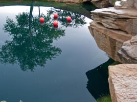
Santa Rosa Blue Hole
41 miles away
Blue Hole: free, open daily. Parking adjacent. Swimming allowed without a permit. Scuba diving requires a certification card shown to the ranger on duty.